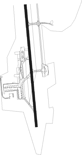
Torp - Sandefjord Torp
Airport details
| Country | Norway |
| State | Vestfold |
| Region | EN |
| Airspace | Polaris Ctr |
| Municipality | Sandefjord |
| Elevation | 286ft (87m) |
| Timezone | GMT +1 |
| Coordinates | 59.18667, 10.25861 |
| Magnetic var | |
| Type | land |
| Available since | X-Plane v10.40 |
| ICAO code | ENTO |
| IATA code | TRF |
| FAA code | n/a |
Communication
| Sandefjord Torp ATIS | 119.075 |
| Sandefjord Torp Ground Control | 126.175 |
| Sandefjord Torp Tower | 118.650 |
| Sandefjord Torp FARRIS TCA | 134.050 |
Approach frequencies
| ILS-cat-II | RW18 | 108.3 | 18.00mi |
| ILS-cat-I | RW36 | 110.95 | 18.00mi |
| 3° GS | RW36 | 110.95 | 18.00mi |
| 3° GS | RW18 | 108.3 | 18.00mi |
Nearby beacons
| code | identifier | dist | bearing | frequency |
|---|---|---|---|---|
| TOR | TORP VOR/DME | 1 | 178° | 113.85 |
| RYG | RYGGE TACAN | 20.2 | 72° | 113.50 |
| YG | ENGE NDB | 20.6 | 72° | 396 |
| RG | TUNE (MOSS) NDB | 24.3 | 80° | 381 |
| SIG | SIGDAL VOR/DME | 53.2 | 323° | 117.70 |
Departure and arrival routes
| Transition altitude | 7000ft |
| SID end points | distance | outbound heading | |
|---|---|---|---|
| RW18 | |||
| ELVO2G | 40mi | 60° | |
| VATE2G | 49mi | 85° | |
| BOMG2G | 22mi | 121° | |
| ELKO1G | 38mi | 210° | |
| LUTO2G | 38mi | 239° | |
| TITU2G | 40mi | 263° | |
| BAKI2G | 35mi | 289° | |
| RW36 | |||
| ELVO2H | 40mi | 60° | |
| VATE2H | 49mi | 85° | |
| BOMG2H | 22mi | 121° | |
| ELKO1H | 38mi | 210° | |
| LUTO2H | 38mi | 239° | |
| TITU2H | 40mi | 263° | |
| BAKI3H | 35mi | 289° | |
| STAR starting points | distance | inbound heading | |
|---|---|---|---|
| RW18 | |||
| ULMU2S | 21.1 | 90° | |
| BAMI2S | 38.0 | 217° | |
| VATE2S | 48.5 | 265° | |
| REPK2S | 25.2 | 317° | |
| ESOS2S | 36.2 | 359° | |
| RW36 | |||
| ULMU7T | 21.1 | 90° | |
| BAMI7T | 38.0 | 217° | |
| VATE7T | 48.5 | 265° | |
| REPK7T | 25.2 | 317° | |
| ESOS7T | 36.2 | 359° | |
Instrument approach procedures
| runway | airway (heading) | route (dist, bearing) |
|---|---|---|
| RW18 | AKIPU (179°) | AKIPU 3000ft ASLAK (6mi, 179°) 3000ft |
| RW18 | BAPTO (136°) | BAPTO 3000ft ASLAK (6mi, 90°) 3000ft |
| RW18 | UNVID (222°) | UNVID 3000ft ASLAK (6mi, 270°) 3000ft |
| RNAV | ASLAK 3000ft EROBU (4mi, 179°) 3000ft ENTO (9mi, 179°) 332ft ENOVA (14mi, 179°) 3000ft NEDZA (13mi, 359°) 5000ft NEDZA (turn) 5000ft | |
| RW36 | LULOP (318°) | LULOP 3000ft ENOVA (6mi, 270°) 3000ft |
| RW36 | NENIX (329°) | NENIX 5000ft ENOVA (6mi, 289°) 3000ft |
| RW36 | UNBAM (42°) | UNBAM 3000ft ENOVA (7mi, 90°) 3000ft |
| RNAV | ENOVA 3000ft TO500 (5mi, 359°) 3000ft ENTO (9mi, 359°) 305ft ASLAK (13mi, 359°) 3000ft NEDZA (14mi, 179°) 5000ft NEDZA (turn) 5000ft |
Holding patterns
| STAR name | hold at | type | turn | heading* | altitude | leg | speed limit |
|---|---|---|---|---|---|---|---|
| ESOS2S | NENIX | VHF | left | 177 (357)° | > 5000ft | 1.0min timed | ICAO rules |
| ESOS7T | NENIX | VHF | left | 177 (357)° | > 5000ft | 1.0min timed | ICAO rules |
| REPK7T | NENIX | VHF | left | 177 (357)° | > 5000ft | 1.0min timed | ICAO rules |
| ULMU2S | ULMUG | VHF | left | 268 (88)° | > 4000ft | 1.0min timed | ICAO rules |
| ULMU7T | ULMUG | VHF | left | 268 (88)° | > 4000ft | 1.0min timed | ICAO rules |
| *) magnetic outbound (inbound) holding course | |||||||
Disclaimer
The information on this website is not for real aviation. Use this data with the X-Plane flight simulator only! Data taken with kind consent from X-Plane 12 source code and data files. Content is subject to change without notice.
