Airports for X-Plane offers a convenient way to explore airports and their related communication information for the X-Plane flight simulator. It only uses data from the X-Plane flight simulator itself, and is therefore more reliable than the data that comes from real aviation websites. You can search for airports by using the ICAO code, or browse for airports per country and state. The information displayed is categorized by airport details, runway information, airport communication, approach frequencies (ILS and Glidepath details), details of nearby beacons, SIDs, STARs and approach procedures.

automated airport weather station public transport luggage city aerodrome outskirts airdrome air terminal passengers airport terminal corporation airstrip airfield traffic pattern commuter airliner nation airport authority airport apron concrete flown

Sitno - Wilcze Laski

Airport details

CountryPoland
StateWest Pomeranian Voivodeship
Region
AirspaceWarsaw Ctr
Municipalitygmina Szczecinek
Elevation523ft (159m)
TimezoneGMT +1
Coordinates53.59727, 16.69930
Magnetic var
Typeland
Available sinceX-Plane v10.40
ICAO codeEP77
IATA coden/a
FAA coden/a

Communication

No airport communication available for EP77
Nearby Points of Interest:
Bismarck tower in Okonek
-
Castle of the Pomeranian Dukes in Szczecinek
-
Saint Stanislaus church in Węgorzewo
-
Church of the Ascension of Christ in Łomczewo
-
Zamek w Czarnem
-
Czaplinek town hall
-
Kościół Podwyższenia Krzyża Świętego w Czaplinku
-
Kościół Narodzenia Najświętszej Maryi Panny w Karsiborze
-
Palace in Białowąs
-
Town hall in Wałcz
-
Church of the Assumption of Mary in Bobolice
-
Saint Anne church in Przechlewo
-
Church of St. John in Głubczyn
-
Saint James the Greater church in Człuchów
-
Człuchów Castle

Runway info

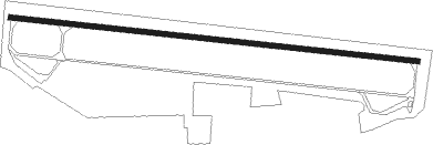
Runway 10 / 28
 length2285m (7497ft)
 bearing96° / 276°
 width32m (105ft)
 surfaceasphalt

Airport layout


Nearby beacons

codeidentifierdistbearingfrequency
CZADME15.1257°117
NAMIROSLAWIEC NDB24.6250°297
TMIMIROSLAWIEC TACAN25.3253°115.35
NDSWIDWIN NDB31.9282°280
TSNSWIDWIN TACAN32.1282°116
TZEDME39.131°113.80
TDADARLOWO TACAN49.9337°116.85
DARDARLOWO VOR/DME50339°114.20
SDARLOWO NDB50.4338°436
SADARLOWO NDB51.2340°474
DREDME56.2228°115.30

Disclaimer

The information on this website is not for real aviation. Use this data with the X-Plane flight simulator only! Data taken with kind consent from X-Plane 12 source code and data files. Content is subject to change without notice.