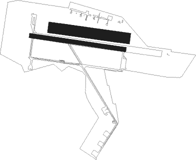
Airports for X-Plane offers a convenient way to explore airports and their related communication information for the X-Plane flight simulator. It only uses data from the X-Plane flight simulator itself, and is therefore more reliable than the data that comes from real aviation websites. You can search for airports by using the ICAO code, or browse for airports per country and state. The information displayed is categorized by airport details, runway information, airport communication, approach frequencies (ILS and Glidepath details), details of nearby beacons, SIDs, STARs and approach procedures.

passenger runway lighting airport terminal transit regional airspace airbase airport aviation heliport port train airfield air safety public transport taxiway airspeed frankfurt airport airport apron arrival

Babice

Airport details

CountryPoland
StateMasovian Voivodeship
RegionEP
AirspaceWarsaw Ctr
MunicipalityWarsaw
Elevation352ft (107m)
TimezoneGMT +1
Coordinates52.27240, 20.90808
Magnetic var
Typeland
Available sinceX-Plane v10.32
ICAO codeEPBC
IATA coden/a
FAA coden/a

Communication

Babice Babice Radio122.300
Nearby Points of Interest:
Saint Mary Magdalene Church in Warsaw (Wawrzyszew)
-
"Nasz Dom" orphanage in Warsaw-Bielany
-
Brühl Palace
-
Kościół Wniebowzięcia Najświętszej Maryi Panny w Starych Babicach
-
34/36, Mickiewicza Street in Warsaw
-
Fabryka Garbarska Temler i Szwede w Warszawie
-
Mostowski Palace in Tarchomin
-
Umschlagplatz in Warsaw ghetto
-
Umschlagplatz monument
-
Bogusławski Palace
-
Museum of Pawiak Prison
-
Synagoga Szpitala Starozakonnych w Warszawie
-
Wolskie Pięciochatki
-
Wiadukt kolejowy przy ul. Armatniej w Warszawie
-
Warszawa Szczęśliwice railway depot
-
20 Chłodna Street in Warsaw
-
Dzialynski Palace
-
Saint Roch church in Lipków
-
Kamienica Jacobsona w Warszawie
-
Mokronowski Palace
-
Warsaw Arsenal
-
Palace of the Ministry of Revenues and Treasury
-
Kamienica, tzw. Pałac Łowczanki (Chodkiewiczowej)
-
Palace of the Four Winds
-
Yitzchak Alter Synagogue in Warsaw

Runway info

Runway 10L / 28R  
 length1001m (3284ft)
 bearing98° / 278°
 width150m (492ft)
 surfacegrass
Runway 10R / 28L  
 length1298m (4259ft)
 bearing98° / 278°
 width64m (211ft)
 surfaceconcrete

Nearby beacons

codeidentifierdistbearingfrequency
OKCOKECIE (WARSAW) VOR/DME6.4153°113.45
WARZABOROWEK VOR/DME9.2267°114.90
MOLMODLIN VOR/DME13.7308°116.60
LINDME22.3144°113.10
KRNDME25.9235°117.80
TMMMINSK MAZOWIECKI TACAN28.296°117.05
NFMINSK MAZOWIECKI NDB29.196°282
DIADME49.418°117.95
NPRTOMASZOW MAZOWIECKI NDB50.6227°488
NPTOMASZOW MAZOWIECKI NDB50.8228°437
TTMTOMASZOW MAZOWIECKI TACAN51230°110.70
NEDDEBLIN NDB53.5127°465
NRRADOM NDB54.1159°313
NRARADOM NDB54.1157°328
NEDEBLIN NDB55.5127°366
TDNDEBLIN TACAN56.5126°108.80

Disclaimer

The information on this website is not for real aviation. Use this data with the X-Plane flight simulator only! Data taken with kind consent from X-Plane 12 source code and data files. Content is subject to change without notice.