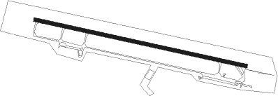
Airports for X-Plane offers a convenient way to explore airports and their related communication information for the X-Plane flight simulator. It only uses data from the X-Plane flight simulator itself, and is therefore more reliable than the data that comes from real aviation websites. You can search for airports by using the ICAO code, or browse for airports per country and state. The information displayed is categorized by airport details, runway information, airport communication, approach frequencies (ILS and Glidepath details), details of nearby beacons, SIDs, STARs and approach procedures.

luggage train city international airport kennedy transit consulate outskirts flight airport authority southwest seaplane terminal pilot ferry flown field landing area jet flights

Borsk

Airport details

CountryPoland
StatePomeranian Voivodeship
RegionEP
AirspaceWarsaw Ctr
MunicipalityBorsk
Elevation465ft (142m)
TimezoneGMT +1
Coordinates53.95111, 17.94778
Magnetic var
Typeland
Available sinceX-Plane v10.40
ICAO codeEPBO
IATA coden/a
FAA coden/a

Communication

No airport communication available for EPBO
Nearby Points of Interest:
Kościół św. Marcina w Starej Kiszewie
-
Holy Trinity church in Kościerzyna
-
Kościerzyna town hall
-
Kościół św. Michała Archanioła w Lipuszu
-
Protestant church in Stężyca
-
Kościół św. Katarzyny Aleksandryjskiej w Śliwicach
-
Kościół św. Jakuba Starszego w Lubichowie
-
Saint Nicholas church in Parchowo
-
Zamek joannitów w Skarszewach
-
Skarszewy town hall
-
Chojnice Town Hall
-
Saint Barbara church in Kokoszkowy
-
Synagogue in Starogard Gdański
-
Adalbert of Prague church in Starogard Gdański
-
Saint Catherine of Alexandria church in Starogard Gdański
-
Old Saint Catherine church in Bytów
-
Wieża ciśnień w Starogardzie Gdańskim (Szpital Kocborowski)
-
Wiechert Palace in Starogard Gdański
-
Saint Martin church in Borzyszkowy
-
Saint James church in Ostrowite
-
Kościół Podwyższenia Krzyża Świętego w Cekcynie
-
Saints Peter and Paul church in Chmielno
-
Saint Roch church in Osiek

Runway info

Runway 10 / 28
 length2291m (7516ft)
 bearing100° / 280°
 width40m (131ft)
 surfaceasphalt
 displ threshold623m (2044ft) / 124m (407ft)

Airport layout


Parking locations

Nearby beacons

codeidentifierdistbearingfrequency
TCWCEWICE TACAN28.5338°113.95
MCEWICE NDB28.7342°423
MLCEWICE NDB28.8347°311
GZDGDANSK VOR/DME31.148°116.10
NEPRUSZCZ GDANSKI NDB31.869°300
NETPRUSZCZ GDANSKI NDB3370°370
TZEDME34.5287°113.80
GRUGRUDZIADZ VOR/DME39.2117°114.60
NWOOKSYWIE (GDYNIA) NDB41.946°494
NWOKSYWIE (GDYNIA) NDB42.344°290
TOWOKSYWIE (GDYNIA) TACAN42.642°113.50
NOOKSYWIE (GDYNIA) NDB43.140°290
NOWOKSYWIE (GDYNIA) NDB43.737°494
WICDME44.7340°108
BYZBYDGOSZCZ VOR/DME51.2178°112.70

Disclaimer

The information on this website is not for real aviation. Use this data with the X-Plane flight simulator only! Data taken with kind consent from X-Plane 12 source code and data files. Content is subject to change without notice.