Airports for X-Plane offers a convenient way to explore airports and their related communication information for the X-Plane flight simulator. It only uses data from the X-Plane flight simulator itself, and is therefore more reliable than the data that comes from real aviation websites. You can search for airports by using the ICAO code, or browse for airports per country and state. The information displayed is categorized by airport details, runway information, airport communication, approach frequencies (ILS and Glidepath details), details of nearby beacons, SIDs, STARs and approach procedures.

consulate capital airborne taxiway transit landing area ferry air traffic control airliner commuter airport authority airports pilot concrete hotel city aircraft carrier control tower embassy aircraft

Pokrówka - Depultycze Krolewskie

Airport details

CountryPoland
StateLublin Voivodeship
RegionEP
AirspaceWarsaw Ctr
MunicipalityDepułtycze Królewskie
Elevation692ft (211m)
TimezoneGMT +1
Coordinates51.08194, 23.43750
Magnetic var
Typeland
Available sinceX-Plane v10.40
ICAO codeEPCD
IATA coden/a
FAA coden/a

Communication

Depultycze Krolewskie DepartureULTYCZE RADIO119.580
Nearby Points of Interest:
Cemetery in Chełm
-
Saint Basil the Great Monastery in Chełm
-
Saint Nicholas Greek Catholic church in Chełm
-
District office building, Chełm
-
Castle in Sielec
-
Orthodox church of Saint John the Evangelist in Chełm
-
Saint Michael Archangel church in Rejowiec
-
Church in Bezek
-
Kościół św. Mateusza w Rudzie-Hucie
-
Cmentarz wojenny z I wojny światowej
-
World War I cemetery in Izbica
-
Saint Nicholas church in Grabowiec
-
Cemetery in Dubienka
-
Holy Trinity Orthodox church in Dubienka
-
Church of Saint Stanislaus in Gorzków
-
St. Stanislaus church in Biskupice
-
World War I Cemetery in Boniewo
-
Branytsky palace, Liuboml
-
Former rectory in Łęczna
-
Big Synagogue in Łęczna
-
Cultural heritage monuments in Łęczna

Runway info

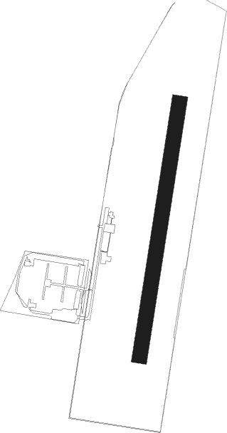
Runway 01R / 19L
 length849m (2785ft)
 bearing21° / 201°
 width50m (164ft)
 surfacegrass

Airport layout


Parking locations

Nearby beacons

codeidentifierdistbearingfrequency
IZBDME16.4235°117.40
SWISWIDNIK VOR/DME29.8282°112.20

Disclaimer

The information on this website is not for real aviation. Use this data with the X-Plane flight simulator only! Data taken with kind consent from X-Plane 12 source code and data files. Content is subject to change without notice.