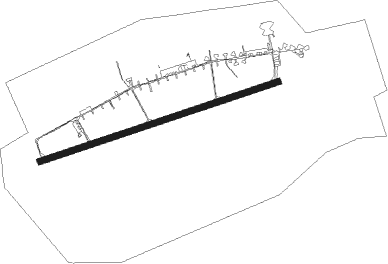
Lębork - Cewice
Airport details
| Country | Poland |
| State | Pomeranian Voivodeship |
| Region | EP |
| Airspace | Warsaw Ctr |
| Municipality | gmina Cewice |
| Elevation | 503ft (153m) |
| Timezone | GMT +1 |
| Coordinates | 54.42187, 17.78041 |
| Magnetic var | |
| Type | land |
| Available since | X-Plane v10.40 |
| ICAO code | EPCE |
| IATA code | n/a |
| FAA code | n/a |
Communication
| Cewice CEWICE TOWER | 126.750 |
| Cewice CEWICE ApproachROACH | 132.425 |
Approach frequencies
| ILS-cat-I | RW25 | 111.3 | 18.00mi |
| 3° GS | RW25 | 111.3 | 18.00mi |
Nearby beacons
| code | identifier | dist | bearing | frequency |
|---|---|---|---|---|
| M | CEWICE NDB | 0.6 | 92° | 423 |
| TCW | CEWICE TACAN | 0.7 | 247° | 113.95 |
| ML | CEWICE NDB | 2.1 | 85° | 311 |
| WIC | DME | 15.8 | 338° | 108 |
| GZD | GDANSK VOR/DME | 22.6 | 93° | 116.10 |
| NOW | OKSYWIE (GDYNIA) NDB | 26.3 | 74° | 494 |
| NO | OKSYWIE (GDYNIA) NDB | 26.8 | 76° | 290 |
| TOW | OKSYWIE (GDYNIA) TACAN | 27 | 78° | 113.50 |
| TZE | DME | 27.8 | 253° | 113.80 |
| NW | OKSYWIE (GDYNIA) NDB | 27.9 | 79° | 290 |
| NWO | OKSYWIE (GDYNIA) NDB | 28.4 | 81° | 494 |
| NE | PRUSZCZ GDANSKI NDB | 33.9 | 101° | 300 |
| NET | PRUSZCZ GDANSKI NDB | 35.5 | 101° | 370 |
Disclaimer
The information on this website is not for real aviation. Use this data with the X-Plane flight simulator only! Data taken with kind consent from X-Plane 12 source code and data files. Content is subject to change without notice.
