Debrzno
Airport details
| Country | Poland |
| State | Greater Poland Voivodeship |
| Region | |
| Airspace | Warsaw Ctr |
| Municipality | gmina Lipka |
| Elevation | 505ft (154m) |
| Timezone | GMT +1 |
| Coordinates | 53.52014, 17.24113 |
| Magnetic var | |
| Type | land |
| Available since | X-Plane v10.40 |
| ICAO code | EPDB |
| IATA code | n/a |
| FAA code | n/a |
Communication
Nearby Points of Interest:
Saint James the Greater church in Człuchów
-Człuchów Castle
-Church of the Visitation in Zamarte
-Church of Saints Jacob and Philip in Obkas
-Church of the Ascension of Christ in Łomczewo
-Saint Stanislaus church in Węgorzewo
-Zamek w Czarnem
-Chojnice Town Hall
-St. Jacob the Apostle Church in Bługowo
-Saint James church in Ostrowite
-Saint Anne church in Przechlewo
-Church of St. John in Głubczyn
-Bismarck tower in Okonek
-Castle of the Pomeranian Dukes in Szczecinek
-Kościół św. Wojciecha w Sadkach
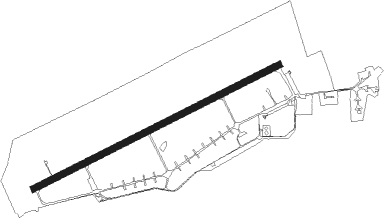
Runway info
| Runway 07 / 25 | ||
| length | 2487m (8159ft) | |
| bearing | 76° / 256° | |
| width | 59m (192ft) | |
| surface | asphalt | |
Nearby beacons
| code | identifier | dist | bearing | frequency |
|---|---|---|---|---|
| CZA | DME | 33.5 | 269° | 117 |
| BYZ | BYDGOSZCZ VOR/DME | 36.4 | 120° | 112.70 |
| TZE | DME | 41.8 | 346° | 113.80 |
| TCW | CEWICE TACAN | 56.8 | 30° | 113.95 |
| M | CEWICE NDB | 57.5 | 32° | 423 |
| ML | CEWICE NDB | 58.4 | 33° | 311 |
| DAR | DARLOWO VOR/DME | 61.3 | 316° | 114.20 |
| TDA | DARLOWO TACAN | 61.6 | 315° | 116.85 |
| S | DARLOWO NDB | 61.9 | 316° | 436 |
| SA | DARLOWO NDB | 62.3 | 317° | 474 |
Disclaimer
The information on this website is not for real aviation. Use this data with the X-Plane flight simulator only! Data taken with kind consent from X-Plane 12 source code and data files. Content is subject to change without notice.