Airports for X-Plane offers a convenient way to explore airports and their related communication information for the X-Plane flight simulator. It only uses data from the X-Plane flight simulator itself, and is therefore more reliable than the data that comes from real aviation websites. You can search for airports by using the ICAO code, or browse for airports per country and state. The information displayed is categorized by airport details, runway information, airport communication, approach frequencies (ILS and Glidepath details), details of nearby beacons, SIDs, STARs and approach procedures.

takeoff station international regional airdrome airbase airport authority faa ferry capital bus road traffic airspace airport terminal airports luggage nearby railway station concrete

Jelenia Góra - Jelenia Gora

Airport details

CountryPoland
StateLower Silesian Voivodeship
RegionEP
AirspaceWarsaw Ctr
MunicipalityJelenia Góra
Elevation1122ft (342m)
TimezoneGMT +1
Coordinates50.89883, 15.78551
Magnetic var
Typeland
Available sinceX-Plane v10.40
ICAO codeEPJG
IATA coden/a
FAA coden/a

Communication

No airport communication available for EPJG
Nearby Points of Interest:
Dąbrowica palace
-
Paulinum Palace in Jelenia Góra
-
Manor in Łomnica
-
Palace "Pałac na Wodzie" in Staniszów
-
Palace in Komarno
-
Saint Joseph church
-
Polish Catholic church in Jelenia Góra
-
Palace in Staniszów
-
Manor House in Radomierz
-
Kościół św. Jadwigi Śląskiej w Karpnikach
-
Kościół ewangelicki w Karpnikach
-
Mausoleum in Bukowiec
-
2 Jagiellońska Street in Jelenia Góra
-
Kościół św. Marcina w Bukowcu (powiat jeleniogórski)
-
Kościół św. Jana Chrzciciela w Bukowcu
-
Palace in Janowice Wielkie
-
Palace in Czernica, Lower Silesian Voivodeship
-
Kościół św. Trójcy w Podgórzynie
-
Palace in Ciszyca
-
1 Miedziana Street in Wojcieszów
-
Castle Nowy Dwór in Kowary
-
Niemitz Palace in Wojcieszów
-
21 Ogrodowa Street in Kowary
-
Palace in Lubiechowa
-
Pałac w Wojcieszowie Górnym

Runway info

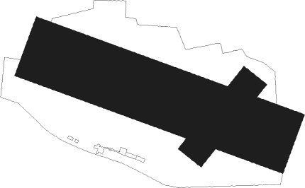
Runway 04 / 22  
 length260m (853ft)
 bearing56° / 236°
 width100m (328ft)
 surfacegrass
Runway 11 / 29  
 length759m (2490ft)
 bearing106° / 286°
 width214m (702ft)
 surfacegrass

Airport layout


Nearby beacons

codeidentifierdistbearingfrequency
OKXFRYDLANT VOR/DME28.5270°114.85
PPARDUBICE NDB53.2181°888
PKPARDUBICE NDB53.3178°432
FCASLAV NDB58.8205°715
CCASLAV NDB60.3201°715
CFCASLAV NDB61.2200°345

Disclaimer

The information on this website is not for real aviation. Use this data with the X-Plane flight simulator only! Data taken with kind consent from X-Plane 12 source code and data files. Content is subject to change without notice.