Airports for X-Plane offers a convenient way to explore airports and their related communication information for the X-Plane flight simulator. It only uses data from the X-Plane flight simulator itself, and is therefore more reliable than the data that comes from real aviation websites. You can search for airports by using the ICAO code, or browse for airports per country and state. The information displayed is categorized by airport details, runway information, airport communication, approach frequencies (ILS and Glidepath details), details of nearby beacons, SIDs, STARs and approach procedures.

concrete arrival military asphalt transit outskirts tarmac downtown flown government airport apron air terminal taxiway drome propeller plane local government aerodromes passengers southwest public transport

Jelenia Góra - Jezow Sudecki

Airport details

CountryPoland
StateLower Silesian Voivodeship
Region
AirspaceWarsaw Ctr
MunicipalityJeżów Sudecki
Elevation1833ft (559m)
TimezoneGMT +1
Coordinates50.94249, 15.76147
Magnetic var
Typeland
Available sinceX-Plane v10.40
ICAO codeEPJS
IATA coden/a
FAA coden/a

Communication

No airport communication available for EPJS
Nearby Points of Interest:
Palace in Czernica, Lower Silesian Voivodeship
-
Paulinum Palace in Jelenia Góra
-
Dąbrowica palace
-
Palace in Komarno
-
Saint Joseph church
-
Manor in Łomnica
-
Palace in Lubiechowa
-
Palace in Nielestno
-
Polish Catholic church in Jelenia Góra
-
Palace "Pałac na Wodzie" in Staniszów
-
Palace in Sokołowiec Górny
-
2 Jagiellońska Street in Jelenia Góra
-
Manor House in Radomierz
-
Town hall in Wleń
-
Rybnica Castle
-
Saint Hedwig church in Wleń
-
Lenno Palace in Łupki
-
Palace in Staniszów
-
Niemitz Palace in Wojcieszów
-
Pałac w Wojcieszowie Górnym
-
Palace in Wojcieszów Dolny
-
Pałac w Sokołowcu Środkowym
-
Palace in Barcinek
-
1 Miedziana Street in Wojcieszów
-
Świerzawa town hall

Runway info

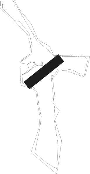
Runway 04 / 22
 length341m (1119ft)
 bearing67° / 247°
 width90m (295ft)
 surfacegrass

Airport layout


Nearby beacons

codeidentifierdistbearingfrequency
OKXFRYDLANT VOR/DME27.7267°114.85
PPARDUBICE NDB55.8179°888
PKPARDUBICE NDB55.9177°432
FCASLAV NDB61.1202°715

Disclaimer

The information on this website is not for real aviation. Use this data with the X-Plane flight simulator only! Data taken with kind consent from X-Plane 12 source code and data files. Content is subject to change without notice.