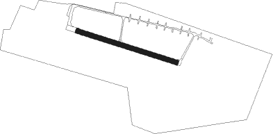
Tarnów Opolski - Kamien Slaski
Airport details
| Country | Poland |
| State | Opole Voivodeship |
| Region | EP |
| Airspace | Warsaw Ctr |
| Municipality | Kamień Śląski |
| Elevation | 683ft (208m) |
| Timezone | GMT +1 |
| Coordinates | 50.52911, 18.08517 |
| Magnetic var | |
| Type | land |
| Available since | X-Plane v10.32 |
| ICAO code | EPKN |
| IATA code | n/a |
| FAA code | n/a |
Communication
Nearby Points of Interest:
Kamień Śląski Palace
-Church of St. Michael the Archangel in Poznowice
-Jewish cemetery in Gogolin
-St. Francis of Assisi Church, Malnia
-Góra Świętej Anny Monastery
-Krapkowice Castle
-St Anne's Hill Calvary
-Jewish cemetery in Krapkowice
-Defensive walls in Krapkowice
-Rogów Opolski Palace
-Holy Trinity Church in Boguszyce
-St Barbara's Church, Strzelce Opolskie
-Corpus Christi Church
-Palace Park
-Strzelce Opolskie Castle
-Strzelce Opolskie Town Hall
-St Lawrence's Church, Strzelce Opolskie
-Prószków Castle
-Dobra Palace
-Szkoła parafialna w Opolu - Nowej Wsi Królewskiej
-Church in Szczepanek
-Saint Nicholas church in Ligota Prószkowska
-Kościół św. Walentego w Walcach
-Post Office in Opole
Nearby beacons
| code | identifier | dist | bearing | frequency |
|---|---|---|---|---|
| WIE | DME | 26.3 | 49° | 109.65 |
| KAX | KATOWICE VOR/DME | 38.3 | 93° | 114.80 |
| PSZ | DME | 43.6 | 125° | 116.90 |
| N | NADA (OSTRAVA) NDB | 49 | 176° | 258 |
| OTA | OSTRAVA VOR/DME | 49.9 | 178° | 117.45 |
| R | RADA (OSTRAVA) NDB | 51 | 180° | 534 |
| TBN | GORNY DME | 57.4 | 308° | 113.60 |
Disclaimer
The information on this website is not for real aviation. Use this data with the X-Plane flight simulator only! Data taken with kind consent from X-Plane 12 source code and data files. Content is subject to change without notice.