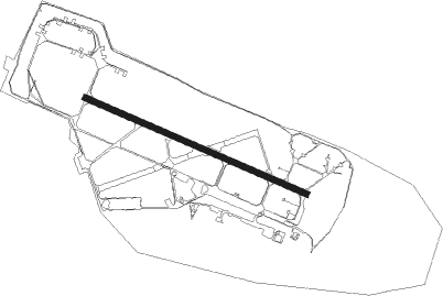
Poznan Krzesiny
Airport details
| Country | Poland |
| State | Greater Poland Voivodeship |
| Region | EP |
| Airspace | Warsaw Ctr |
| Municipality | Poznań |
| Elevation | 274ft (84m) |
| Timezone | GMT +1 |
| Coordinates | 52.33194, 16.96667 |
| Magnetic var | |
| Type | land |
| Available since | X-Plane v10.40 |
| ICAO code | EPKS |
| IATA code | n/a |
| FAA code | n/a |
Communication
Approach frequencies
| ILS-cat-I | RW29 | 111.9 | 18.00mi |
| 3° GS | RW29 | 111.9 | 18.00mi |
Nearby beacons
| code | identifier | dist | bearing | frequency |
|---|---|---|---|---|
| TKS | KRZESINY (POZNAN) TACAN | 0 | 36° | 111.50 |
| NK | KRZESINY (POZNAN) NDB | 1.2 | 108° | 489 |
| LAW | LAWICA (POZNAN) VOR/DME | 7.3 | 304° | 115.80 |
| CMP | CZEMPIN VOR/DME | 15 | 231° | 114.50 |
| TPW | POWIDZ TACAN | 32.5 | 87° | 115.55 |
| NT | POWIDZ NDB | 33.6 | 87° | 303 |
| NG | POWIDZ NDB | 34 | 88° | 322 |
Departure and arrival routes
| Transition altitude | 6500ft |
| SID end points | distance | outbound heading | |
|---|---|---|---|
| RW11 | |||
| EKTI1E | 38mi | 85° | |
| OLDO1E | 25mi | 92° | |
| BEST1E | 40mi | 144° | |
| TITQ1E | 30mi | 246° | |
| UVCO1E | 53mi | 328° | |
| RW29 | |||
| ODMI1W | 24mi | 5° | |
| BEST1W | 40mi | 144° | |
| TITQ1W | 30mi | 246° | |
| UVCO1W | 53mi | 328° | |
| STAR starting points | distance | inbound heading | |
|---|---|---|---|
| RW11 | |||
| TITQ1Y | 30.3 | 66° | |
| UVCO1Y | 53.3 | 148° | |
| ODMI1Y | 23.5 | 185° | |
| EKTI1Y | 38.2 | 265° | |
| BEST1Y | 39.5 | 324° | |
| RW29 | |||
| TITQ1S | 30.3 | 66° | |
| UVCO1S | 53.3 | 148° | |
| DUDC1S | 32.0 | 259° | |
| EKTI1S | 38.2 | 265° | |
| BEST1S | 39.5 | 324° | |
Disclaimer
The information on this website is not for real aviation. Use this data with the X-Plane flight simulator only! Data taken with kind consent from X-Plane 12 source code and data files. Content is subject to change without notice.
