Airports for X-Plane offers a convenient way to explore airports and their related communication information for the X-Plane flight simulator. It only uses data from the X-Plane flight simulator itself, and is therefore more reliable than the data that comes from real aviation websites. You can search for airports by using the ICAO code, or browse for airports per country and state. The information displayed is categorized by airport details, runway information, airport communication, approach frequencies (ILS and Glidepath details), details of nearby beacons, SIDs, STARs and approach procedures.

airport check-in flights jetliner air terminal road grass airfield traffic pattern aircraft stolport control tower international airport airstrip concrete hospital consulate airborne airport apron airport station passengers

Legnica

Airport details

CountryPoland
StateLower Silesian Voivodeship
Region
AirspaceWarsaw Ctr
MunicipalityLegnica
Elevation407ft (124m)
TimezoneGMT +1
Coordinates51.18146, 16.16682
Magnetic var
Typeland
Available sinceX-Plane v10.40
ICAO codeEPLE
IATA coden/a
FAA coden/a

Communication

No airport communication available for EPLE
Nearby Points of Interest:
City Park in Legnica
-
Orthodox church of the Resurrection of Christ in Legnica
-
Scultetus Tenement House
-
Aleja platanowa w Legnicy
-
Manor in Babin
-
Kościół Najświętszego Serca Pana Jezusa w Kościelcu
-
Pałac w Lipcach
-
Palace in Tyńczyk Legnicki
-
St. Jadwiga's Basilica, Legnickie Pole
-
Pałac w Pątnówku
-
Kościół Narodzenia Najświętszej Maryi Panny w Małuszowie
-
Pałac w Czerwonym Kościele
-
Palace in Jakuszów
-
Palace in Lubień
-
Dwór w Bielowicach
-
Kościół Wniebowzięcia Najświętszej Maryi Panny w Krotoszycach
-
Manor in Krajów
-
Pałac w Lubiatowie
-
Christ the King church in Spalona
-
Palace in Rogoźnik
-
Manor in Snowidza
-
Pałac w Pątnowie
-
Kościół św. Andrzeja Apostoła w Męcince
-
Palace in Polanka
-
Kościół Matki Bożej Różańcowej w Wądrożu Wielkim

Runway info

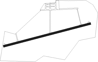
Runway 08 / 26
 length1594m (5230ft)
 bearing84° / 264°
 width40m (131ft)
 surfaceconcrete

Airport layout


Nearby beacons

codeidentifierdistbearingfrequency
WCLWROCLAW VOR/DME28.897°111.65
TBNGORNY DME36.885°113.60
ZLGZIELONA GORA VOR/DME59.2339°110.65
CMPCZEMPIN VOR/DME60.730°114.50

Disclaimer

The information on this website is not for real aviation. Use this data with the X-Plane flight simulator only! Data taken with kind consent from X-Plane 12 source code and data files. Content is subject to change without notice.