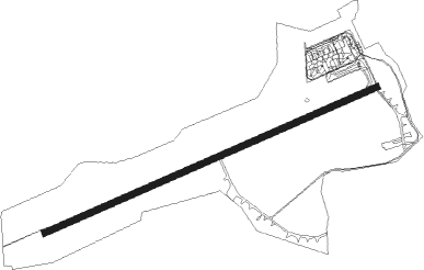
Łódź - Lodz Lublinek
Airport details
| Country | Poland |
| State | Łódź Voivodeship |
| Region | EP |
| Airspace | Warsaw Ctr |
| Municipality | Łódź |
| Elevation | 604ft (184m) |
| Timezone | GMT +1 |
| Coordinates | 51.72194, 19.39806 |
| Magnetic var | |
| Type | land |
| Available since | X-Plane v10.40 |
| ICAO code | EPLL |
| IATA code | LCJ |
| FAA code | n/a |
Communication
| Lodz Lublinek ATIS | 135.675 |
| Lodz Lublinek LODZ | 124.225 |
Approach frequencies
| ILS-cat-I | RW25 | 110.5 | 18.00mi |
| 3° GS | RW25 | 110.5 | 18.00mi |
Nearby Points of Interest:
Teodor Milsch's villa
-Kamienica Gottlieba Beera
-University Clinical Hospital No. 2
-Hugo Warrikoff's animal clinic
-Oskar Ziegler's villa
-Izba Skarbowa in Łódź
-Henryk Michel's villa
-John, Krebs & CO Factory (Fakora)
-Gustaw Kindermann's palace
-Niemieckie Gimnazjum Reformowane
-Reinchardt Bennich's palace
-PZU building in Łódź
-Adam Osser's factory in Łódź
-Schychts' tenement house
-Józef Balle's factory
-Benedykt Górski's manor
-15 Roosevelta Street in Łódź
-Tenement house at Roosvelt 17 st. in Łódź
-Leon Rosset's tenement house
-3 Andrzeja Struga Street
-2 Andrzeja Struga Street
-J. Hofman's house in Łódź
-Szaja Goldblum's tenement house
-Esplanada in Łódź
-Magazyn Konfekcyjny Emila Schmechela
Nearby beacons
| code | identifier | dist | bearing | frequency |
|---|---|---|---|---|
| LOZ | WIACZYN DOLNY VOR/DME | 9 | 77° | 112.40 |
| TAS | LASK TACAN | 13.1 | 232° | 108.55 |
| NWT | LECZYCA NDB | 17.5 | 327° | 385 |
| NW | LECZYCA NDB | 18.5 | 322° | 520 |
| TLY | LECZYCA TACAN | 19.2 | 318° | 110.10 |
| TTM | TOMASZOW MAZOWIECKI TACAN | 27.1 | 101° | 110.70 |
| NP | TOMASZOW MAZOWIECKI NDB | 28.4 | 101° | 437 |
| NPR | TOMASZOW MAZOWIECKI NDB | 29.9 | 102° | 488 |
| PCK | DME | 59.7 | 10° | 117.65 |
| WIE | DME | 60.7 | 227° | 109.65 |
Departure and arrival routes
| Transition altitude | 6500ft |
| SID end points | distance | outbound heading | |
|---|---|---|---|
| RW07 | |||
| ADOX1S | 23mi | 16° | |
| VIDE1S | 19mi | 116° | |
| BAXI1S | 21mi | 279° | |
| UTOL1S | 22mi | 288° | |
| RW25 | |||
| ADOX1W | 23mi | 16° | |
| VIDE1W | 19mi | 116° | |
| BAXI1W | 21mi | 279° | |
| UTOL1W | 22mi | 288° | |
| STAR starting points | distance | inbound heading | |
|---|---|---|---|
| RW07 | |||
| ABAK1R | 12.0 | 82° | |
| UTOL1R | 22.3 | 108° | |
| ADOX1R | 23.2 | 196° | |
| SOXE1R | 27.7 | 239° | |
| VIDE1R | 19.2 | 296° | |
| RW25 | |||
| ABAK1T | 12.0 | 82° | |
| UTOL1T | 22.3 | 108° | |
| ADOX1T | 23.2 | 196° | |
| SOXE1T | 27.7 | 239° | |
| VIDE1T | 19.2 | 296° | |
Instrument approach procedures
| runway | airway (heading) | route (dist, bearing) |
|---|---|---|
| RW07 | LL701 (101°) | LL701 4000ft LL711 (2mi, 173°) LL721 (4mi, 150°) 2700ft |
| RNAV | LL721 2700ft LL731 (4mi, 78°) 2000ft EPLL (5mi, 78°) 642ft LL751 (7mi, 78°) LL701 (17mi, 272°) 3000ft | |
| RW25 | LL501 (257°) | LL501 3000ft LL531 (2mi, 252°) 2300ft |
| RNAV | LL531 2300ft LL532 (2mi, 258°) 2100ft EPLL (5mi, 258°) 656ft LL503 (5mi, 258°) LL501 (14mi, 77°) 3000ft |
Disclaimer
The information on this website is not for real aviation. Use this data with the X-Plane flight simulator only! Data taken with kind consent from X-Plane 12 source code and data files. Content is subject to change without notice.