Airports for X-Plane offers a convenient way to explore airports and their related communication information for the X-Plane flight simulator. It only uses data from the X-Plane flight simulator itself, and is therefore more reliable than the data that comes from real aviation websites. You can search for airports by using the ICAO code, or browse for airports per country and state. The information displayed is categorized by airport details, runway information, airport communication, approach frequencies (ILS and Glidepath details), details of nearby beacons, SIDs, STARs and approach procedures.

arriving corporation tarmac flight stolport taxiway railway station near aviation faa airdrome airspeed public transport government airspace nearby asphalt passengers airborne metro

Lubin

Airport details

CountryPoland
StateLower Silesian Voivodeship
RegionEP
AirspaceWarsaw Ctr
MunicipalityLubin
Elevation512ft (156m)
TimezoneGMT +1
Coordinates51.42301, 16.19616
Magnetic var
Typeland
Available sinceX-Plane v10.40
ICAO codeEPLU
IATA coden/a
FAA coden/a

Communication

Lubin Lubin Radio122.400
Nearby Points of Interest:
Głogów Tower in Lubin
-
Town hall in Lubin
-
Lubin Castle
-
Castle Chapel in Lubin
-
Sacred Heart church in Lubin
-
Palace in Składowice
-
Palace in Księginice
-
Palace in Rynarcice
-
Palace in Krzeczyn Wielki
-
Palace in Krzeczyn Mały
-
Palace in Siedlce
-
Pałac w Starej Rudnej
-
Palace in Tarnówek
-
Kościół ewangelicki w Jędrzychowie
-
Kościół św. Bartłomieja Apostoła w Jędrzychowie
-
Palace in Raszowa
-
Pałac w Ręszowie
-
Polkowice Town Hall
-
Dutch mill in Polkowice
-
Palace in Dziesław
-
Palace in Raszowa Mała
-
Church of St. John the Baptist in Grodowiec
-
Palace in Krzydłowice
-
Kościół św. Marii Magdaleny w Krzydłowicach
-
Holy Family church in Parszowice

Runway info

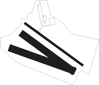
Runway 13L / 31R  
 length1001m (3284ft)
 bearing118° / 298°
 width30m (98ft)
 surfaceasphalt
Runway 11 / 29  
 length901m (2956ft)
 bearing106° / 286°
 width100m (328ft)
 surfacegrass
Runway 13R / 31L  
 length851m (2792ft)
 bearing118° / 298°
 width100m (328ft)
 surfacegrass

Airport layout


Nearby beacons

codeidentifierdistbearingfrequency
WCLWROCLAW VOR/DME33.6115°111.65
TBNGORNY DME36.299°113.60
ZLGZIELONA GORA VOR/DME45.5331°110.65
CMPCZEMPIN VOR/DME46.836°114.50
NKKRZESINY (POZNAN) NDB61.642°489
TKSKRZESINY (POZNAN) TACAN61.740°111.50
LAWLAWICA (POZNAN) VOR/DME64.432°115.80

Disclaimer

The information on this website is not for real aviation. Use this data with the X-Plane flight simulator only! Data taken with kind consent from X-Plane 12 source code and data files. Content is subject to change without notice.