Airports for X-Plane offers a convenient way to explore airports and their related communication information for the X-Plane flight simulator. It only uses data from the X-Plane flight simulator itself, and is therefore more reliable than the data that comes from real aviation websites. You can search for airports by using the ICAO code, or browse for airports per country and state. The information displayed is categorized by airport details, runway information, airport communication, approach frequencies (ILS and Glidepath details), details of nearby beacons, SIDs, STARs and approach procedures.

commuter air safety port plane runway downtown corporation consulate grass hotel airplane frankfurt airport public transport airline aircraft carrier helipad nearby air traffic control airport apron aviation

Leczyca

Airport details

CountryPoland
StateŁódź Voivodeship
RegionEP
AirspaceWarsaw Ctr
MunicipalityOpole
Elevation402ft (123m)
TimezoneGMT +1
Coordinates52.00500, 19.14389
Magnetic var
Typeland
Available sinceX-Plane v10.40
ICAO codeEPLY
IATA coden/a
FAA coden/a

Communication

No airport communication available for EPLY
Nearby Points of Interest:
Town Hall in Łęczyca
-
Monastery of the Immaculate Conception of the Blessed Virgin Mary in Łęczyca
-
Kościół św. Małgorzaty w Górze św. Małgorzaty
-
Saint Stanislaus church in Grabów
-
Besiekiery Castle
-
Town hall in Aleksandrów Łódzki
-
Saint Lawrence church in Piątek
-
Orthodox chapel in Uniejów
-
synagoge in Dąbie
-
Former lutheran churches in Dąbie nad Nerem
-
Dąbie town hall
-
Uniejów Castle
-
Saint Nicholas church in Wierzchy
-
Lutomiersk Monastery
-
Ludwik Heinzel's palace in Łódź
-
Kapliczka św. Rocha i św. Sebastiana w Łodzi
-
Pałac Saski w Kutnie
-
Church of the Nativity of the Virgin Mary in Chełmno nad Nerem
-
Town hall in Kutno
-
Jewish cemetery in Kutno
-
Corpus Christi church in Orłów-Parcel
-
Manor in Wodzierady
-
Kłodawa Town Hall
-
Łódź Old Cemetery - Orthodox section
-
cmentarz katolicki przy ulicy Ogrodowej w Łodzi

Runway info

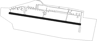
Runway 10 / 28
 length2480m (8136ft)
 bearing98° / 278°
 width60m (197ft)
 surfaceasphalt

Airport layout


Nearby beacons

codeidentifierdistbearingfrequency
TLYLECZYCA TACAN0.2177°110.10
NWLECZYCA NDB1.399°520
NWTLECZYCA NDB2.999°385
LOZWIACZYN DOLNY VOR/DME22.5115°112.40
TASLASK TACAN27.3176°108.55
TTMTOMASZOW MAZOWIECKI TACAN43.2114°110.70
NPTOMASZOW MAZOWIECKI NDB44.5114°437
PCKDME45.231°117.65
TIRINOWROCLAW TACAN57.5315°109.25
NRINOWROCLAW NDB57.8316°262
NRDINOWROCLAW NDB57.9317°444

Disclaimer

The information on this website is not for real aviation. Use this data with the X-Plane flight simulator only! Data taken with kind consent from X-Plane 12 source code and data files. Content is subject to change without notice.