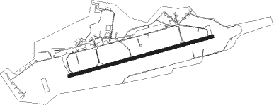
Malbork
Airport details
| Country | Poland |
| State | Pomeranian Voivodeship |
| Region | EP |
| Airspace | Warsaw Ctr |
| Municipality | gmina Stare Pole |
| Elevation | 19ft (6m) |
| Timezone | GMT +1 |
| Coordinates | 54.02667, 19.13556 |
| Magnetic var | |
| Type | land |
| Available since | X-Plane v10.40 |
| ICAO code | EPMB |
| IATA code | n/a |
| FAA code | n/a |
Communication
| MALBORK MALBORK TOWER | 128.500 |
| MALBORK MALBORK ApproachROACH | 128.500 |
Approach frequencies
| ILS-cat-I | RW25 | 110.5 | 18.00mi |
| 3° GS | RW25 | 110.5 | 18.00mi |
Nearby Points of Interest:
Baptist church in Malbork
-Old Town Hall of Malbork
-City water tower in Malbork
-Our Lady Help of Christians church in Sztum
-Saint Matthew church in Nowy Staw
-Former protestant church in Nowy Staw
-Wiatrak w Wikrowie
-Kościół św. Piotra i Pawła w Starym Mieście
-11 Sigismund Augustus Boulevard in Elbląg
-Church of the Holy Spirit in Elbląg
-Saint Nicholas church in Cyganek
-Dawny kościół św. Jana Chrzciciela w Ostaszewie
-Bażantarnia (Elbląg)
-Pałac w Barzynie
-Gniew Town Hall
-Kościół Matki Boskiej Królowej Świata w Przezmarku
-Bishop castle in Prabuty
-Saint Mary chapel in Prabuty
-Elbląg Canal
-Kościół Matki Niepokalanego Serca Najświętszej Maryi Panny w Pomorskiej Wsi
-Sacred Heart church in Stegna
-Cmentarz żydowski w Pasłęku
-Church of the Nativity of the Virgin Mary in Piaseczno
-Saint George church in Pasłęk
-Saint James church in Dzierżążno
Nearby beacons
| code | identifier | dist | bearing | frequency |
|---|---|---|---|---|
| TMB | MALBORK TACAN | 0.1 | 131° | 117.10 |
| NB | MALBORK NDB | 1.1 | 84° | 345 |
| KMI | DME | 10.5 | 3° | 116.80 |
| NET | PRUSZCZ GDANSKI NDB | 18.7 | 299° | 370 |
| NE | PRUSZCZ GDANSKI NDB | 20.1 | 297° | 300 |
| GRU | GRUDZIADZ VOR/DME | 32.8 | 215° | 114.60 |
| GZD | GDANSK VOR/DME | 33 | 297° | 116.10 |
| NWO | OKSYWIE (GDYNIA) NDB | 37.1 | 313° | 494 |
| NW | OKSYWIE (GDYNIA) NDB | 38.3 | 312° | 290 |
| TOW | OKSYWIE (GDYNIA) TACAN | 39.9 | 311° | 113.50 |
| NO | OKSYWIE (GDYNIA) NDB | 40.9 | 311° | 290 |
| NOW | OKSYWIE (GDYNIA) NDB | 42.6 | 311° | 494 |
Disclaimer
The information on this website is not for real aviation. Use this data with the X-Plane flight simulator only! Data taken with kind consent from X-Plane 12 source code and data files. Content is subject to change without notice.