Airports for X-Plane offers a convenient way to explore airports and their related communication information for the X-Plane flight simulator. It only uses data from the X-Plane flight simulator itself, and is therefore more reliable than the data that comes from real aviation websites. You can search for airports by using the ICAO code, or browse for airports per country and state. The information displayed is categorized by airport details, runway information, airport communication, approach frequencies (ILS and Glidepath details), details of nearby beacons, SIDs, STARs and approach procedures.

runway lighting airport authority southwest hotel outskirts public transport transit aerodromes jet plane airport apron immigration airfield traffic pattern airplane airdrome international air safety luggage warfare regional

Mrągowo - Mragowo

Airport details

CountryPoland
StateWarmian-Masurian Voivodeship
Region
AirspaceWarsaw Ctr
Municipalitygmina Mrągowo
Elevation488ft (149m)
TimezoneGMT +1
Coordinates53.82274, 21.31552
Magnetic var
Typeland
Available sinceX-Plane v10.40
ICAO codeEPMG
IATA coden/a
FAA coden/a

Communication

No airport communication available for EPMG
Nearby Points of Interest:
Synagoga w Mrągowie
-
Mrągowo Town Hall
-
Lutheran church in Mrągowo
-
Lutheran church in Sorkwity
-
Sorkwity Palace
-
Holy Trinity church in Mikołajki
-
Evangelical church in Kobułty
-
Lutheran church in Rańsk
-
Palace in Łężany
-
Bezławki Castle
-
Palace in Nakomiady
-
Święta Lipka Sanctuary
-
Saint John the Baptist church in Biskupiec
-
Reszel Town Hall
-
Stara Synagoga w Kętrzynie
-
Maximilian Kolbe church in Jerutki
-
Orthodox church of the Nativity of Our Lady in Kętrzyn
-
Saint Catherine of Alexandria church in Kętrzyn
-
Old Town Hall in Kętrzyn
-
Wieża ciśnień w Kętrzynie
-
Saint James the Greater church in Bartołty Wielkie
-
Our Lady of the Gate of Dawn church in Tołkiny
-
Our Lady Queen of Poland church in Garbno
-
Church of the Assumption in Szczytno
-
Castle in Szczytno

Runway info

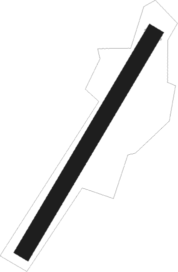
Runway 03 / 21
 length687m (2254ft)
 bearing50° / 230°
 width46m (151ft)
 surfacegrass

Airport layout


Nearby beacons

codeidentifierdistbearingfrequency
MRAMRAGOWO VOR/DME6.8258°117.30
SYNSZYMANY VOR/DME16.9235°111.05
DIADME44.9191°117.95

Disclaimer

The information on this website is not for real aviation. Use this data with the X-Plane flight simulator only! Data taken with kind consent from X-Plane 12 source code and data files. Content is subject to change without notice.