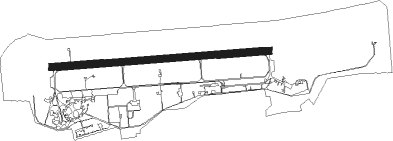
Jakubów - Minsk Mazowiecki
Airport details
| Country | Poland |
| State | Masovian Voivodeship |
| Region | EP |
| Airspace | Warsaw Ctr |
| Municipality | Janów |
| Elevation | 603ft (184m) |
| Timezone | GMT +1 |
| Coordinates | 52.19556, 21.65583 |
| Magnetic var | |
| Type | land |
| Available since | X-Plane v10.40 |
| ICAO code | EPMM |
| IATA code | n/a |
| FAA code | n/a |
Communication
Approach frequencies
| ILS-cat-I | RW26 | 111.3 | 18.00mi |
| 3° GS | RW26 | 111.3 | 18.00mi |
Nearby Points of Interest:
Kościół św. Anny w Jakubowie
-Mariavite Church in Mińsk Mazowiecki
-Mariavite church in Cegłów
-Kościół Ofiarowania Najświętszej Maryi Panny w Siennicy
-Kościół Świętych Apostołów Piotra i Pawła w Dębem Wielkim
-Kościół św. Wawrzyńca w Gliniance
-Kościół św. Wojciecha w Jeruzalu
-Kościół św. Wojciecha
-Mariavite church in Żeliszew Duży
-Jewish cemetery in Okuniew
-Willa Gurewicza in Otwock
-Otwock town hall
-Holy Trinity church in Borowie
-Liw Castle
-Willa Jakubówka
-Kościół św. Apostołów Andrzeja i Bartłomieja w Osiecku
-Wesoła Cemetery
-Mariavite Church in Pogorzel
-Pod Kogutkiem villa in Warsaw
-National Defence University of Warsaw
-Saint Raphael Kalinowski Church in Warsaw
-Starawieś Palace
-Church of the Visitation in Miastków Kościelny
-Willa Granzowa
-Dworek Grochowski w Warszawie
Nearby beacons
| code | identifier | dist | bearing | frequency |
|---|---|---|---|---|
| TMM | MINSK MAZOWIECKI TACAN | 0.3 | 97° | 117.05 |
| NF | MINSK MAZOWIECKI NDB | 1.3 | 90° | 282 |
| SIE | SIEDLCE VOR/DME | 20.2 | 94° | 114.70 |
| LIN | DME | 24.2 | 242° | 113.10 |
| OKC | OKECIE (WARSAW) VOR/DME | 25.6 | 268° | 113.45 |
| WAR | ZABOROWEK VOR/DME | 36.9 | 274° | 114.90 |
| NED | DEBLIN NDB | 37.5 | 165° | 465 |
| NE | DEBLIN NDB | 38.9 | 162° | 366 |
| MOL | MODLIN VOR/DME | 39 | 285° | 116.60 |
| TDN | DEBLIN TACAN | 39.5 | 160° | 108.80 |
| ND | DEBLIN NDB | 40.4 | 158° | 366 |
| NDE | DEBLIN NDB | 41.6 | 156° | 465 |
| NRA | RADOM NDB | 49.7 | 205° | 328 |
| NR | RADOM NDB | 50.5 | 207° | 313 |
| DIA | DME | 55.8 | 331° | 117.95 |
Disclaimer
The information on this website is not for real aviation. Use this data with the X-Plane flight simulator only! Data taken with kind consent from X-Plane 12 source code and data files. Content is subject to change without notice.