Nowe Miasto Nad Pilicą - Nowe Miasto Nad Pilica
Airport details
| Country | Poland |
| State | Masovian Voivodeship |
| Region | |
| Airspace | Warsaw Ctr |
| Municipality | Łęgonice |
| Elevation | 511ft (156m) |
| Timezone | GMT +1 |
| Coordinates | 51.62493, 20.51894 |
| Magnetic var | |
| Type | land |
| Available since | X-Plane v10.40 |
| ICAO code | EPNM |
| IATA code | n/a |
| FAA code | n/a |
Communication
Nearby Points of Interest:
Saint Roch church in Łęgonice
-Kościół św. Kazimierza i klasztor kapucynów w Nowym Mieście nad Pilicą
-Saint Anne chapel in Studzianna
-Saint Joseph church in Studzianna
-Kościół św. Doroty w Potworowie
-Rawa Mazowiecka Town Hall
-Church of the Assumption in Rawa Mazowiecka
-Kościół św. Marcina z Tours w Radzanowie
-Saint Margaret of Antioch church in Czerniewice
-Jewish cemetery in Przysucha
-Saints John of Nepomuk and Ignatius of Loyola church in Przysucha
-Adalbert of Prague church in Lewiczyn
-Kościół św. Marii Magdaleny w Promnej
-Osuchów Palace
-Saint Mary Magdalene church in Opoczno
-Opoczno Castle
-Kościół św. Szczepana w Skrzynnie
-Kościół św. Marcina w Tomaszowie Mazowieckim (stary)
-Kościół św. Katarzyny w Wieniawie
-Grójec Town Hall
-Kościół Zesłania Ducha Świętego w Jasieńcu
-Jewish cemetery in Mszczonów
-Kościół św. Michała Archanioła w Puszczy Mariańskiej
-Kościół św. Kazimierza Królewicza w Radziejowicach
-Cemetery of St. Roch in Skierniewice
Runway info
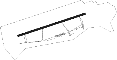
| Runway 08 / 26 | ||
| length | 2394m (7854ft) | |
| bearing | 81° / 261° | |
| width | 59m (195ft) | |
| surface | concrete | |
Nearby beacons
| code | identifier | dist | bearing | frequency |
|---|---|---|---|---|
| NPR | TOMASZOW MAZOWIECKI NDB | 13.7 | 261° | 488 |
| NP | TOMASZOW MAZOWIECKI NDB | 15 | 263° | 437 |
| TTM | TOMASZOW MAZOWIECKI TACAN | 16 | 265° | 110.70 |
| KRN | DME | 19.5 | 347° | 117.80 |
| LIN | DME | 30.1 | 64° | 113.10 |
| NR | RADOM NDB | 30.3 | 108° | 313 |
| NRA | RADOM NDB | 31.5 | 106° | 328 |
| LOZ | WIACZYN DOLNY VOR/DME | 34.4 | 280° | 112.40 |
| OKC | OKECIE (WARSAW) VOR/DME | 36.5 | 39° | 113.45 |
| WAR | ZABOROWEK VOR/DME | 38.4 | 12° | 114.90 |
| MOL | MODLIN VOR/DME | 50 | 11° | 116.60 |
| JED | DME | 59.5 | 195° | 115.60 |
Disclaimer
The information on this website is not for real aviation. Use this data with the X-Plane flight simulator only! Data taken with kind consent from X-Plane 12 source code and data files. Content is subject to change without notice.