Airports for X-Plane offers a convenient way to explore airports and their related communication information for the X-Plane flight simulator. It only uses data from the X-Plane flight simulator itself, and is therefore more reliable than the data that comes from real aviation websites. You can search for airports by using the ICAO code, or browse for airports per country and state. The information displayed is categorized by airport details, runway information, airport communication, approach frequencies (ILS and Glidepath details), details of nearby beacons, SIDs, STARs and approach procedures.

metro runway lighting tarmac faa warfare flight attendant international landing airbus airdrome consulate kennedy control tower nearby luggage customs traffic airbase public transport aviation

Opole - Opole Polska Nowa Wies

Airport details

CountryPoland
StateOpole Voivodeship
RegionEP
AirspaceWarsaw Ctr
MunicipalityPolska Nowa Wieś
Elevation616ft (188m)
TimezoneGMT +1
Coordinates50.63334, 17.78167
Magnetic var
Typeland
Available sinceX-Plane v10.40
ICAO codeEPOP
IATA coden/a
FAA coden/a

Communication

No airport communication available for EPOP
Nearby Points of Interest:
Saints Peter and Paul church in Chróścina Opolska
-
Palace in Ciepielowice
-
Dwór, XVII/XVIII
-
Prószków Castle
-
Saint Nicholas church in Ligota Prószkowska
-
Tułowice Palace
-
Communal cemetery in Opole
-
Gmach Rejencji, ob. Urząd Wojewódzki
-
Archiwum Państwowe w Opolu
-
Rynek 1
-
Market Square in Opole
-
Post Office in Opole
-
Old city in Opole
-
Holy Trinity Church in Boguszyce
-
Szkoła parafialna w Opolu - Nowej Wsi Królewskiej
-
Holy Name of Mary church in Szydłowiec Śląski
-
Saint Barbara chapel
-
Saint James church in Skorogoszcz
-
Lewin Brzeski Town Hall
-
Holy Trinity Church in Gracze
-
Palace in Lewin Brzeski
-
Rogów Opolski Palace
-
Church of SS Peter and Paul in Lewin Brzeski
-
St. Francis of Assisi Church, Malnia
-
Chrzelice Castle

Runway info

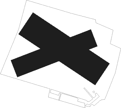
Runway 07 / 25  
 length738m (2421ft)
 bearing79° / 259°
 width195m (640ft)
 surfacegrass
Runway 13 / 31  
 length719m (2359ft)
 bearing117° / 297°
 width284m (931ft)
 surfacegrass

Airport layout


Nearby beacons

codeidentifierdistbearingfrequency
WIEDME30.971°109.65
WCLWROCLAW VOR/DME42.7298°111.65
TBNGORNY DME45.6315°113.60
NNADA (OSTRAVA) NDB56.9159°258
OTAOSTRAVA VOR/DME57.5161°117.45
RRADA (OSTRAVA) NDB58.4162°534

Disclaimer

The information on this website is not for real aviation. Use this data with the X-Plane flight simulator only! Data taken with kind consent from X-Plane 12 source code and data files. Content is subject to change without notice.