Sobienie Jeziory - Sobienie Krolewskie
Airport details
| Country | Poland |
| State | Masovian Voivodeship |
| Region | |
| Airspace | Warsaw Ctr |
| Municipality | Sobienie Biskupie |
| Elevation | 312ft (95m) |
| Timezone | GMT +1 |
| Coordinates | 51.95301, 21.34775 |
| Magnetic var | |
| Type | land |
| Available since | X-Plane v10.40 |
| ICAO code | EPSJ |
| IATA code | n/a |
| FAA code | n/a |
Communication
Nearby Points of Interest:
Mariavite Church in Pogorzel
-Kościół św. Apostołów Andrzeja i Bartłomieja w Osiecku
-Parish Church in Czersk
-Immaculate Conception church in Góra Kalwaria
-Town hall in Góra Kalwaria
-Church of the Lord's Supper in Góra Kalwaria
-Jewish cemetery (Góra Kalwaria)
-Willa Gurewicza in Otwock
-Otwock town hall
-Kościół św. Wawrzyńca w Gliniance
-Tower of the Assumption of the Blessed Virgin Mary church in Konstancin-Jeziorna
-Willa Jakubówka
-Warka town hall
-House of Veteran Actors of Polish Scenes in Skolimów
-Kościół Ofiarowania Najświętszej Maryi Panny w Siennicy
-Kościół św. Wojciecha
-Catholic cemetery in Piaseczno
-Kościół Świętego Jana Chrzciciela w Górznie
-Natolin
-Kościół Świętych Apostołów Piotra i Pawła w Dębem Wielkim
-Pod Kogutkiem villa in Warsaw
-Mariavite Church in Mińsk Mazowiecki
-Holy Trinity church in Borowie
-Saint Anne church in Warsaw-Wilanów
-Kościół św. Katarzyny w Ryczywole
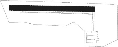
Runway info
| Runway 09 / 27 | ||
| length | 773m (2536ft) | |
| bearing | 93° / 273° | |
| width | 50m (163ft) | |
| surface | grass | |
Nearby beacons
| code | identifier | dist | bearing | frequency |
|---|---|---|---|---|
| LIN | DME | 7.1 | 264° | 113.10 |
| TMM | MINSK MAZOWIECKI TACAN | 18.6 | 53° | 117.05 |
| NF | MINSK MAZOWIECKI NDB | 19.3 | 55° | 282 |
| OKC | OKECIE (WARSAW) VOR/DME | 19.3 | 299° | 113.45 |
| NED | DEBLIN NDB | 28.4 | 129° | 465 |
| NE | DEBLIN NDB | 30.4 | 127° | 366 |
| TDN | DEBLIN TACAN | 31.4 | 126° | 108.80 |
| WAR | ZABOROWEK VOR/DME | 31.4 | 294° | 114.90 |
| ND | DEBLIN NDB | 32.5 | 126° | 366 |
| NRA | RADOM NDB | 33.2 | 187° | 328 |
| KRN | DME | 33.4 | 270° | 117.80 |
| SIE | SIEDLCE VOR/DME | 33.7 | 77° | 114.70 |
| NR | RADOM NDB | 33.8 | 191° | 313 |
| NDE | DEBLIN NDB | 34 | 125° | 465 |
| MOL | MODLIN VOR/DME | 38.8 | 307° | 116.60 |
Disclaimer
The information on this website is not for real aviation. Use this data with the X-Plane flight simulator only! Data taken with kind consent from X-Plane 12 source code and data files. Content is subject to change without notice.