Airports for X-Plane offers a convenient way to explore airports and their related communication information for the X-Plane flight simulator. It only uses data from the X-Plane flight simulator itself, and is therefore more reliable than the data that comes from real aviation websites. You can search for airports by using the ICAO code, or browse for airports per country and state. The information displayed is categorized by airport details, runway information, airport communication, approach frequencies (ILS and Glidepath details), details of nearby beacons, SIDs, STARs and approach procedures.

airliner landing concrete hospital taxiway flight attendant airdrome ferry airborne runway lighting stolport rail flown train aerodrome flights airline outskirts airplane commuter

Krepa K/slupska

Airport details

CountryPoland
StatePomeranian Voivodeship
RegionEP
AirspaceWarsaw Ctr
MunicipalityKrępa Słupska
Elevation251ft (77m)
TimezoneGMT +1
Coordinates54.40843, 17.09562
Magnetic var
Typeland
Available sinceX-Plane v10.40
ICAO codeEPSK
IATA codeOSP
FAA coden/a

Communication

Krepa k/Slupska Krepa Radio118.250
Nearby Points of Interest:
Evangelical-Augsburg church in Słupsk
-
Poczta w Słupsku
-
11 Zwycięstwa Square in Słupsk
-
Słupsk Town Hall
-
4 Old Market Square in Słupsk
-
Słupsk New Town Hall
-
Księżna Anna
-
Pałac
-
Manor in Barnowo
-
Salvator church in Ustka
-
City office in Sławno
-
Brama Koszalińska
-
Krąg Castle
-
Old Saint Catherine church in Bytów
-
Saint Stanislaus Kostka church in Wałdowo
-
Manor in Cecenowo
-
Our Lady of the Rosary church in Sierakowo Sławieńskie
-
Saint Nicholas church in Parchowo

Runway info

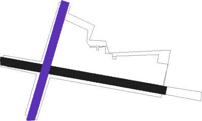
Runway 10 / 28  
 length1028m (3373ft)
 bearing99° / 279°
 width50m (164ft)
 surfacegrass
 displ threshold210m (689ft) / 0m (0ft)
Runway 02 / 20
 length743m (2438ft)
 bearing33° / 213°
 width50m (164ft)
 surfacegrass

Airport layout - runway 02 / 20


Parking locations

Nearby beacons

codeidentifierdistbearingfrequency
TZEDME11.9186°113.80
TCWCEWICE TACAN23.389°113.95
SADARLOWO NDB24.4272°474
MCEWICE NDB24.589°423
DARDARLOWO VOR/DME24.7270°114.20
SDARLOWO NDB25.4270°436
TDADARLOWO TACAN25.7270°116.85
WICDME25.965°108
MLCEWICE NDB2689°311
CZADME60.9221°117

Disclaimer

The information on this website is not for real aviation. Use this data with the X-Plane flight simulator only! Data taken with kind consent from X-Plane 12 source code and data files. Content is subject to change without notice.