Olsztyn-mazury
Airport details
| Country | Poland |
| State | Warmian-Masurian Voivodeship |
| Region | EP |
| Airspace | Warsaw Ctr |
| Municipality | gmina Szczytno |
| Elevation | 461ft (141m) |
| Timezone | GMT +1 |
| Coordinates | 53.48429, 20.93338 |
| Magnetic var | |
| Type | land |
| Available since | X-Plane v10.40 |
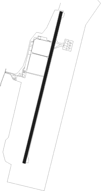
| ICAO code | EPSY |
| IATA code | SZY |
| FAA code | n/a |
Communication
| Olsztyn-Mazury TOWER | 118.025 |
Approach frequencies
| ILS-cat-I | RW01 | 108.1 | 18.00mi |
| 3° GS | RW01 | 108.1 | 18.00mi |
Nearby Points of Interest:
Kościół św. Stanisława Kostki w Szczytnie
-Evangelical church in Szczytno
-Town Hall in Szczytno
-Castle in Szczytno
-Church of the Assumption in Szczytno
-Kościół św. Józefa i Matki Bożej Częstochowskiej w Jedwabnie
-Maximilian Kolbe church in Jerutki
-Town Hall in Pasym
-Immaculate Conception church in Czarnia
-Lutheran church in Rańsk
-Saint James the Greater church in Bartołty Wielkie
-Evangelical church in Kobułty
-Brewery in Nidzica
-Nidzica Town Hall
-Kościół Znalezienia Krzyża Św. w Klebarku Wielkim
-Saint Stanislaus church in Waplewo
-Synagogue in Barczewo
-Protestant Church in Barczewo
-Mury miejskie w Barczewie
-Town hall in Barczewo
-Church of St. Anne and St. Stefan in Barczewo
-Barczewo Castle
-Sorkwity Palace
-Saint John the Baptist church in Biskupiec
-Lutheran church in Sorkwity
Nearby beacons
| code | identifier | dist | bearing | frequency |
|---|---|---|---|---|
| SYN | SZYMANY VOR/DME | 7.8 | 32° | 111.05 |
| MRA | MRAGOWO VOR/DME | 19.4 | 34° | 117.30 |
| DIA | DME | 25.8 | 149° | 117.95 |
| OSY | DME | 28.5 | 291° | 116.25 |
Departure and arrival routes
| Transition altitude | 6500ft |
| SID end points | distance | outbound heading | |
|---|---|---|---|
| RW01 | |||
| LUSU1S | 24mi | 46° | |
| UDRO1S | 14mi | 204° | |
| NIVO1S | 33mi | 280° | |
| RW19 | |||
| LUSU1W | 24mi | 46° | |
| UDRO1W | 14mi | 204° | |
| NIVO1W | 33mi | 280° | |
| STAR starting points | distance | inbound heading | |
|---|---|---|---|
| RW01 | |||
| UDRO1R | 13.8 | 24° | |
| IBIN1R | 34.3 | 95° | |
| ARDU1R | 23.9 | 212° | |
| RW19 | |||
| UDRO2T | 13.8 | 24° | |
| IBIN2T | 34.3 | 95° | |
| ARDU2T | 23.9 | 212° | |
Instrument approach procedures
| runway | airway (heading) | route (dist, bearing) |
|---|---|---|
| RW01 | SY366 (67°) | SY366 4000ft SY369 (7mi, 101°) 2500ft |
| RNAV | SY369 2500ft SY371 (5mi, 29°) 2000ft EPSY (5mi, 26°) 490ft SY372 (4mi, 34°) SY366 (16mi, 241°) 4000ft |
Holding patterns
| STAR name | hold at | type | turn | heading* | altitude | leg | speed limit |
|---|---|---|---|---|---|---|---|
| ARDU1R | SY366 | VHF | left | 304 (124)° | 4000ft - 6000ft | 1.0min timed | 230 |
| IBIN1R | SY366 | VHF | left | 304 (124)° | 4000ft - 6000ft | 1.0min timed | 230 |
| UDRO1R | SY366 | VHF | left | 304 (124)° | 4000ft - 6000ft | 1.0min timed | 230 |
| *) magnetic outbound (inbound) holding course | |||||||
Disclaimer
The information on this website is not for real aviation. Use this data with the X-Plane flight simulator only! Data taken with kind consent from X-Plane 12 source code and data files. Content is subject to change without notice.