Airports for X-Plane offers a convenient way to explore airports and their related communication information for the X-Plane flight simulator. It only uses data from the X-Plane flight simulator itself, and is therefore more reliable than the data that comes from real aviation websites. You can search for airports by using the ICAO code, or browse for airports per country and state. The information displayed is categorized by airport details, runway information, airport communication, approach frequencies (ILS and Glidepath details), details of nearby beacons, SIDs, STARs and approach procedures.

air traffic control airstrip consulate propeller plane immigration gravel passengers flown landing train airspeed non-towered airport air safety customs ferry metro airport port airborne taxiway

Toruń - Torun

Airport details

CountryPoland
StateKuyavian-Pomeranian Voivodeship
RegionEP
AirspaceWarsaw Ctr
MunicipalityToruń
Elevation164ft (50m)
TimezoneGMT +1
Coordinates53.02921, 18.54589
Magnetic var
Typeland
Available sinceX-Plane v10.40
ICAO codeEPTO
IATA coden/a
FAA coden/a

Communication

Torun Aero122.200
Nearby Points of Interest:
Church of Saint Joseph
-
City Park in Torun
-
Manor in Przysiek
-
Bydgoskie Przedmieście
-
15/17 Mickiewicza Street in Toruń
-
Artillery Arsenal in Toruń
-
District court in Toruń
-
Kuyavian-Pomeranian Regional Assembly building in Toruń
-
Tony Halik Explorers’ Museum
-
Budynek Banku Gospodarstwa Krajowego w Toruniu
-
Cesar Arche in Toruń
-
2 Panny Marii Street in Toruń
-
Koci Łeb Tower in Toruń
-
Former Born & Schütze Factory in Toruń
-
Main Post Office in Toruń
-
60 Podmurna Street in Toruń
-
Rynek Staromiejski
-
29 Old Town Market Square in Toruń
-
3 Dominikańska Street in Toruń
-
Meissner Palace in Toruń
-
30 Podmurna Street in Toruń
-
Lutheran chapel in Toruń
-
Toruń city walls
-
Monstrance Tower in Toruń
-
17 New Town Market Square in Toruń

Runway info

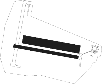
Runway 10L / 28R  
 length938m (3077ft)
 bearing99° / 279°
 width150m (492ft)
 surfacegrass
Runway 10R / 28L  
 length1177m (3862ft)
 bearing99° / 279°
 width57m (187ft)
 surfaceconcrete

Airport layout


Parking locations

Nearby beacons

codeidentifierdistbearingfrequency
NRDINOWROCLAW NDB12.8224°444
NRINOWROCLAW NDB13.7226°262
TIRINOWROCLAW TACAN14.6227°109.25
BYZBYDGOSZCZ VOR/DME21.1277°112.70
GRUGRUDZIADZ VOR/DME30.726°114.60
NTPOWIDZ NDB46226°303
NGPOWIDZ NDB46.1225°322
TPWPOWIDZ TACAN46.6227°115.55
TMBMALBORK TACAN63.431°117.10

Disclaimer

The information on this website is not for real aviation. Use this data with the X-Plane flight simulator only! Data taken with kind consent from X-Plane 12 source code and data files. Content is subject to change without notice.