Airports for X-Plane offers a convenient way to explore airports and their related communication information for the X-Plane flight simulator. It only uses data from the X-Plane flight simulator itself, and is therefore more reliable than the data that comes from real aviation websites. You can search for airports by using the ICAO code, or browse for airports per country and state. The information displayed is categorized by airport details, runway information, airport communication, approach frequencies (ILS and Glidepath details), details of nearby beacons, SIDs, STARs and approach procedures.

nearby station luggage train station consulate airborne rail transport airdock air terminal tarmac frankfurt airport landing taxi immigration control tower near bus nation hospital aircraft carrier

Zamość - Zamosc-mokre

Airport details

CountryPoland
StateLublin Voivodeship
RegionEP
AirspaceWarsaw Ctr
MunicipalityMokre
Elevation750ft (229m)
TimezoneGMT +1
Coordinates50.70195, 23.20417
Magnetic var
Typeland
Available sinceX-Plane v10.40
ICAO codeEPZA
IATA coden/a
FAA coden/a

Communication

No airport communication available for EPZA
Nearby Points of Interest:
Kościół Matki Bożej Szkaplerznej i św. Dominika w Łabuniach
-
Jewish Cemetery in Szczebrzeszyn
-
1 Słodka Street in Szczebrzeszyn
-
Church of the Dormition in Szczebrzeszyn
-
Cmentarz wojenny z I wojny światowej
-
Browar w Zwierzyńcu
-
World War I cemetery in Izbica
-
Saint Nicholas church in Szczebrzeszyn
-
Synagogue in Józefów
-
Saint Nicholas church in Grabowiec
-
Church of Saint Stanislaus in Gorzków
-
Saint Michael Archangel church in Łosiniec
-
Kościół św. Jana Nepomucena w Suścu
-
Jewish Cemetery in Frampol
-
Our Lady Queen of Poland church in Bełżec
-
World War I cemetery in Bełżec
-
Narol town hall
-
Greek Catholic church in Narol
-
Saint Stanislaus the bishop church in Jarczów
-
Synagogue in Łaszczów
-
Cerkiew Podwyższenia Krzyża Świętego w Żurawcach
-
Castle in Sielec
-
Saint Michael Archangel church in Rejowiec
-
Cmentarz wojenny z I wojny światowej w Maziarni

Runway info

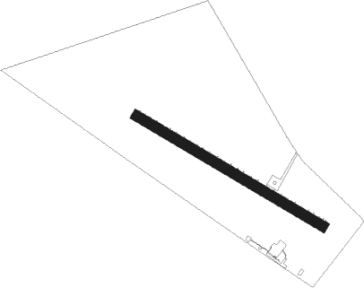
Runway 12 / 30
 length923m (3028ft)
 bearing114° / 294°
 width46m (150ft)
 surfacegrass

Airport layout


Nearby beacons

codeidentifierdistbearingfrequency
IZBDME10.7343°117.40
SWISWIDNIK VOR/DME37.6316°112.20
LIVLVIV VOR/DME60.6140°115.50

Disclaimer

The information on this website is not for real aviation. Use this data with the X-Plane flight simulator only! Data taken with kind consent from X-Plane 12 source code and data files. Content is subject to change without notice.