Airports for X-Plane offers a convenient way to explore airports and their related communication information for the X-Plane flight simulator. It only uses data from the X-Plane flight simulator itself, and is therefore more reliable than the data that comes from real aviation websites. You can search for airports by using the ICAO code, or browse for airports per country and state. The information displayed is categorized by airport details, runway information, airport communication, approach frequencies (ILS and Glidepath details), details of nearby beacons, SIDs, STARs and approach procedures.

field passengers local government helipad jet downtown customs warfare taxiway transit automated airport weather station taxi international airport station hangar traffic jetliner airfield hotel government

Staroźreby - Zdziar Lopatki

Airport details

CountryPoland
StateMasovian Voivodeship
Region
AirspaceWarsaw Ctr
Municipalitygmina Staroźreby
Elevation441ft (134m)
TimezoneGMT +1
Coordinates52.63410, 20.06667
Magnetic var
Typeland
Available sinceX-Plane v10.40
ICAO codeEPZL
IATA coden/a
FAA coden/a

Communication

Zdziar Lopatki Radio123.450
Nearby Points of Interest:
Our Lady of the Rosary and Saint Stanislaus church in Drobin
-
Kościół św. Floriana w Radzanowie
-
Our Lady of Częstochowa church in Baboszewo
-
Mokrzyk Castle
-
Mariavite Monastery in Felicjanów
-
Church of the Assumption in Raciąż
-
Kościół św. Zygmunta w Żukowie
-
Kościół św. Trójcy w Naruszewie
-
Dwór w Glinojecku
-
Kościół św. Marcina w Zawidzu Kościelnym
-
Saint Michael chapel in Płock
-
Dominican Abbey in Płock
-
Small Synagogue in Płock
-
Town hall in Płock
-
Saint John the Baptist church in Sochocin
-
Saint Hedwig church in Stara Biała
-
Holy Trinity church in Wyszogród
-
Our Lady of the Angels church in Wyszogród
-
Palace in Słubice
-
The manor complex in Zdunowo
-
Synagogue in Radzanów
-
Gąbin town hall
-
Kościół św. Józefa w Rościszewie
-
Kościół Świętej Trójcy w Sannikach
-
Sierpc town hall

Runway info

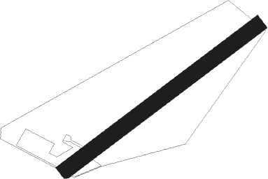
Runway 06 / 24
 length606m (1988ft)
 bearing69° / 249°
 width40m (131ft)
 surfacegrass

Airport layout


Nearby beacons

codeidentifierdistbearingfrequency
PCKDME18.6279°117.65
MOLMODLIN VOR/DME24.8107°116.60
WARZABOROWEK VOR/DME31.2122°114.90
OKCOKECIE (WARSAW) VOR/DME43117°113.45
KRNDME43.5151°117.80
NWTLECZYCA NDB49.4233°385
NWLECZYCA NDB50.1234°520
TLYLECZYCA TACAN50.9236°110.10
LOZWIACZYN DOLNY VOR/DME54207°112.40
SYNSZYMANY VOR/DME67.544°111.05

Disclaimer

The information on this website is not for real aviation. Use this data with the X-Plane flight simulator only! Data taken with kind consent from X-Plane 12 source code and data files. Content is subject to change without notice.