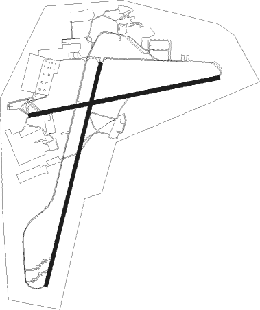
Linköping - Linköping Malmen
Airport details
| Country | Sweden |
| State | Östergötlands län |
| Region | ES |
| Airspace | Sweden Ctr |
| Municipality | Linköping |
| Elevation | 308ft (94m) |
| Timezone | GMT +1 |
| Coordinates | 58.40245, 15.51269 |
| Magnetic var | |
| Type | land |
| Available since | X-Plane v10.40 |
| ICAO code | ESCF |
| IATA code | n/a |
| FAA code | n/a |
Communication
| Linköping Malmen Ground Control | 121.850 |
| Linköping Malmen Tower | 132.600 |
| Linköping Malmen Tower | 121.050 |
| Linköping Malmen Tower | 129.800 |
| Linköping Malmen Approach (Ostgota app.) | 132.950 |
Approach frequencies
| ILS-cat-I | RW19 | 110.1 | 18.00mi |
| ILS-cat-I | RW01 | 108.35 | 18.00mi |
| 3.2° GS | RW19 | 110.1 | 18.00mi |
| 3° GS | RW01 | 108.35 | 18.00mi |
Nearby beacons
| code | identifier | dist | bearing | frequency |
|---|---|---|---|---|
| SC | SAAB (LINKOPING) NDB | 2.2 | 53° | 300 |
| LCF | MALMEN (LINKOPING) NDB | 5 | 205° | 285 |
| VSN | VASSEN VOR/DME | 8.6 | 117° | 115.25 |
| OL | SAAB (LINKOPING) NDB | 9.2 | 95° | 415 |
| ON | NORRKOPING NDB | 29.3 | 78° | 324 |
| RB | OREBRO NDB | 46.7 | 325° | 375 |
| EN | OREBRO NDB | 55.1 | 333° | 400 |
Instrument approach procedures
| runway | airway (heading) | route (dist, bearing) |
|---|---|---|
| RW01 | CF550 (347°) | CF550 2100ft CF721 (5mi, 280°) 2100ft |
| RW01 | CF722 (58°) | CF722 2700ft CF721 (5mi, 100°) 2100ft |
| RW01 | CF723 (30°) | CF723 3000ft CF721 (3mi, 32°) 2100ft |
| RNAV | CF721 2100ft CF720 (5mi, 32°) 2100ft ESCF (7mi, 27°) 301ft (3584mi, 195°) 2500ft (turn) 2500ft | |
| RW19 | CF532 (243°) | CF532 2100ft CF531 (5mi, 280°) 2100ft |
| RW19 | CF533 (215°) | CF533 2700ft CF531 (3mi, 213°) 2100ft |
| RW19 | CF850 (170°) | CF850 2700ft CF531 (5mi, 100°) 2100ft |
| RNAV | CF531 2100ft CF530 (5mi, 212°) 2100ft ESCF (5mi, 218°) 351ft (3584mi, 195°) 2500ft (turn) 2500ft |
Disclaimer
The information on this website is not for real aviation. Use this data with the X-Plane flight simulator only! Data taken with kind consent from X-Plane 12 source code and data files. Content is subject to change without notice.

