Airports for X-Plane offers a convenient way to explore airports and their related communication information for the X-Plane flight simulator. It only uses data from the X-Plane flight simulator itself, and is therefore more reliable than the data that comes from real aviation websites. You can search for airports by using the ICAO code, or browse for airports per country and state. The information displayed is categorized by airport details, runway information, airport communication, approach frequencies (ILS and Glidepath details), details of nearby beacons, SIDs, STARs and approach procedures.

airdock pilot stol buildings passengers arrival airspeed airport airport authority commuter kennedy immigration gravel helipad air terminal traffic flight tarmac propeller plane stolport

Moholm - Moholm Airbase

Airport details

CountrySweden
StateVästra Götalands län
RegionES
AirspaceSweden Ctr
MunicipalityTöreboda kommun
Elevation294ft (90m)
TimezoneGMT +1
Coordinates58.59750, 14.11083
Magnetic var
Typeland
Available sinceX-Plane v10.40
ICAO codeESFM
IATA coden/a
FAA coden/a

Communication

No airport communication available for ESFM
Nearby Points of Interest:
Bällefors socken
-
Ekeskogs socken
-
Mo socken
-
Fägre socken
-
Valla tingshus
-
Västergötland Runic Inscription 8
-
Hjälstads socken
-
Vads socken
-
Vaholms bro
-
Trästena socken
-
Götlunda socken
-
Beateberg socken
-
Sveneby socken
-
Vg 7 Sörgården, Vallby
-
Sveneby herrgård
-
Halna socken
-
Flistads socken, Västergötland
-
Bäcks socken
-
Björkängs socken
-
Värings socken
-
Utby socken
-
Odensåkers socken
-
Odensåkers klockarbol
-
Ekby socken
-
Locketorps socken

Runway info

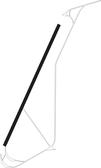
Runway 03 / 21
 length1695m (5561ft)
 bearing47° / 227°
 width40m (131ft)
 surfaceasphalt
 displ threshold0m (0ft) / 620m (2034ft)
 blast zone145m (476ft) / 150m (492ft)

Airport layout


Nearby beacons

codeidentifierdistbearingfrequency
NSSKOVDE NDB5.3235°384
KBGKARLSBORG NDB10.8113°312
SSSKOVDE NDB17.5217°390
RBOREBRO NDB42.459°375
OAJONKOPING NDB46.2180°338
JONJONKOPING VOR/DME50.2183°115.80
ENOREBRO NDB5154°400
SKSKARLSTAD NDB53.5313°330
OJJONKOPING NDB54.1185°403
KSDKARLSTAD VOR/DME56.1317°117.80
NKSKARLSTAD NDB60324°341

Disclaimer

The information on this website is not for real aviation. Use this data with the X-Plane flight simulator only! Data taken with kind consent from X-Plane 12 source code and data files. Content is subject to change without notice.