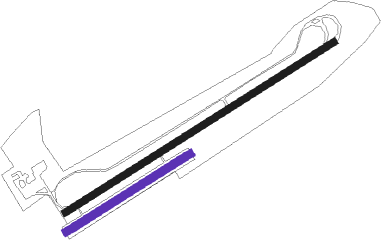
Lidköping - Lidkoping
Airport details
| Country | Sweden |
| State | Västra Götalands län |
| Region | ES |
| Airspace | Sweden Ctr |
| Municipality | Lidköpings kommun |
| Elevation | 200ft (61m) |
| Timezone | GMT +1 |
| Coordinates | 58.46528, 13.17444 |
| Magnetic var | |
| Type | land |
| Available since | X-Plane v10.40 |
| ICAO code | ESGL |
| IATA code | LDK |
| FAA code | n/a |
Communication
| Lidkoping AFIS | 124.450 |
Nearby beacons
| code | identifier | dist | bearing | frequency |
|---|---|---|---|---|
| LG | SATENAS NDB | 14.4 | 269° | 309 |
| SG | SATENAS NDB | 15.6 | 260° | 409 |
| SS | SKOVDE NDB | 24.4 | 101° | 390 |
| NS | SKOVDE NDB | 26.3 | 86° | 384 |
| PG | TROLLHATTAN-VANERSBORG NDB | 26.8 | 255° | 325 |
| FM | TROLLHATTAN-VANERSBORG NDB | 28.5 | 263° | 399 |
| FEN | DME | 38.5 | 297° | 115.35 |
| SDH | DME | 43.6 | 205° | 115.65 |
| OA | JONKOPING NDB | 48.5 | 124° | 338 |
| JON | JONKOPING VOR/DME | 50.8 | 128° | 115.80 |
| NL | LANDVETTER (GOTEBORG) NDB | 51.3 | 228° | 369 |
| OJ | JONKOPING NDB | 53.5 | 132° | 403 |
| PGG | DME | 53.8 | 233° | 113.35 |
| SKS | KARLSTAD NDB | 54.8 | 6° | 330 |
| LAV | LANDVETTER (GOTEBORG) VOR/DME | 56.1 | 228° | 114.60 |
| KSD | KARLSTAD VOR/DME | 58.8 | 9° | 117.80 |
| HGG | DME | 59.8 | 224° | 113.95 |
| SL | LANDVETTER (GOTEBORG) NDB | 60.4 | 228° | 342 |
Disclaimer
The information on this website is not for real aviation. Use this data with the X-Plane flight simulator only! Data taken with kind consent from X-Plane 12 source code and data files. Content is subject to change without notice.

