Stockholm / Nyköping - Stockholm Skavsta
Airport details
| Country | Sweden |
| State | Södermanlands län |
| Region | ES |
| Airspace | Sweden Ctr |
| Municipality | Nyköpings kommun |
| Elevation | 140ft (43m) |
| Timezone | GMT +1 |
| Coordinates | 58.78861, 16.90361 |
| Magnetic var | |
| Type | land |
| Available since | X-Plane v10.40 |
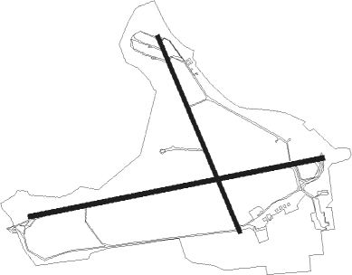
| ICAO code | ESKN |
| IATA code | NYO |
| FAA code | n/a |
Communication
| Stockholm Skavsta ATIS | 126.275 |
| Stockholm Skavsta Tower ATC freq. | 127.700 |
| Stockholm Skavsta OSTGOTA Approach | 132.950 |
Approach frequencies
| LOC | RW08 | 111.3 | 18.00mi |
| ILS-cat-I | RW26 | 111.9 | 18.00mi |
| 3° GS | RW26 | 111.9 | 18.00mi |
Nearby Points of Interest:
Kappla källa
-Södermanlands runinskrifter 122
-Södermanlands runinskrifter 123
-Södermanland Runic Inscription 121
-Tistad Castle
-Södermanlands runinskrifter 163
-Södermanland Runic Inscription 367
-Södermanlands runinskrifter 45
-Släbro
-Södermanlands runinskrifter 164
-Vida regementsskrivarställe
-Helgona socken
-Bergshammar socken
-Bärbo socken
-Södermanlands runinskrifter 50
-Stora Kungsladugården
-Södermanlands runinskrifter 48
-Stigtomta socken
-Tingshuset, Nyköping
-Tuna socken
-Sankta Annas sjukhus
-Nyköping Town
-Nyköpings stadshus och rådhus
-Prosten Pihls gård
-Södermanlands runinskrifter 51

Nearby beacons
| code | identifier | dist | bearing | frequency |
|---|---|---|---|---|
| NW | SKAVSTA (STOCKHOLM) NDB | 3.8 | 268° | 364 |
| PEO | SKAVSTA (STOCKHOLM) NDB | 4.3 | 87° | 398 |
| ON | NORRKOPING NDB | 20.3 | 249° | 324 |
| TRS | TROSA VOR/DME | 20.6 | 76° | 114.30 |
| LX | ESKILSTUNA NDB | 29.8 | 339° | 402 |
| COR | CORNER NDB | 33.5 | 51° | 388 |
| RD | VAESTERAAS AB (STOCKHOLM) NDB | 44.7 | 338° | 419 |
| LNA | LENA NDB | 47.1 | 31° | 330 |
| ARS | AROS VOR/DME | 48.5 | 342° | 112.80 |
| LE | VAESTERAAS AB (STOCKHOLM) NDB | 53 | 345° | 333 |
| ASW | (STOCKHOLM) DME | 55.6 | 49° | 113.75 |
| ANW | (STOCKHOLM) DME | 62.7 | 46° | 112.05 |
Departure and arrival routes
| Transition altitude | 5000ft |
| SID end points | distance | outbound heading | |
|---|---|---|---|
| RW08 | |||
| TRS2P | 21mi | 76° | |
| INGI3K | 21mi | 108° | |
| TONS2K | 16mi | 245° | |
| TIPI3K | 14mi | 287° | |
| RW26 | |||
| TRS3M | 21mi | 76° | |
| INGI3L | 21mi | 108° | |
| TONS3L | 16mi | 245° | |
| KOXI3L | 43mi | 252° | |
| LIBS3L | 21mi | 265° | |
| STAR starting points | distance | inbound heading | |
|---|---|---|---|
| RW08 | |||
| PELU2S | 33.3 | 40° | |
| GIML2S | 14.7 | 86° | |
| NILU2C | 30.5 | 268° | |
| INGI2S | 20.5 | 288° | |
| RW26 | |||
| PELU2T | 33.3 | 40° | |
| GIML2D, GIML2T | 33.3 | 86° | |
| TRS4F | 20.6 | 256° | |
| NILU2D | 30.5 | 268° | |
| INGI2T | 20.5 | 288° | |
Disclaimer
The information on this website is not for real aviation. Use this data with the X-Plane flight simulator only! Data taken with kind consent from X-Plane 12 source code and data files. Content is subject to change without notice.