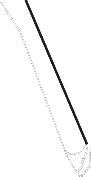
Strängnäs - Strängnäs Airbase
Airport details
| Country | Sweden |
| State | Södermanlands län |
| Region | |
| Airspace | Sweden Ctr |
| Municipality | Strängnäs kommun |
| Elevation | 139ft (42m) |
| Timezone | GMT +1 |
| Coordinates | 59.32120, 17.10461 |
| Magnetic var | |
| Type | land |
| Available since | X-Plane v10.40 |
| ICAO code | ESKS |
| IATA code | n/a |
| FAA code | n/a |
Communication
Approach frequencies
| ILS-cat-III | RW15 | 109.55 | 18.00mi |
| ILS-cat-III | RW33 | 111.35 | 18.00mi |
| 3° GS | RW15 | 109.55 | 18.00mi |
| 3° GS | RW33 | 111.35 | 18.00mi |
Nearby beacons
| code | identifier | dist | bearing | frequency |
|---|---|---|---|---|
| COR | CORNER NDB | 12.1 | 99° | 388 |
| LX | ESKILSTUNA NDB | 12.3 | 263° | 402 |
| LNA | LENA NDB | 15.2 | 49° | 330 |
| RD | VAESTERAAS AB (STOCKHOLM) NDB | 19.3 | 291° | 419 |
| ARS | AROS VOR/DME | 21.1 | 300° | 112.80 |
| LE | VAESTERAAS AB (STOCKHOLM) NDB | 24.5 | 308° | 333 |
| TRS | TROSA VOR/DME | 26 | 134° | 114.30 |
| ASW | (STOCKHOLM) DME | 27 | 70° | 113.75 |
| PEO | SKAVSTA (STOCKHOLM) NDB | 31.5 | 187° | 398 |
| ARL | ARLANDA (STOCKHOLM) VOR/DME | 31.7 | 68° | 116 |
| WA | ARLANDA (STOCKHOLM) NDB | 31.8 | 68° | 348 |
| ASE | (STOCKHOLM) DME | 32.1 | 70° | 114.45 |
| ANW | (STOCKHOLM) DME | 32.7 | 62° | 112.05 |
| NW | SKAVSTA (STOCKHOLM) NDB | 33.7 | 211° | 364 |
| ANE | (STOCKHOLM) DME | 36.7 | 69° | 113.30 |
| UP | UPPSALA NDB | 43.4 | 42° | 366 |
| ON | NORRKOPING NDB | 49.5 | 224° | 324 |
Departure and arrival routes
| SID end points | distance | outbound heading | |
|---|---|---|---|
| RW15 | |||
| LOML1K | 140mi | 288° | |
| PUMJ1K | 183mi | 292° | |
| BATO1K | 150mi | 296° | |
| RW33 | |||
| LOML1L | 140mi | 288° | |
| PUMJ1L | 183mi | 292° | |
| STAR starting points | distance | inbound heading | |
|---|---|---|---|
| RW15 | |||
| INBE1S | 160.3 | 108° | |
| RW33 | |||
| INBE1T | 160.3 | 108° | |
| NISG1T | 135.1 | 111° | |
Instrument approach procedures
| runway | airway (heading) | route (dist, bearing) |
|---|---|---|
| RW15 | KS852 (113°) | KS852 4800ft KS851 (5mi, 72°) 4700ft |
| RW15 | KS853 (114°) | KS853 4800ft KS851 (2mi, 126°) 4700ft |
| RW15 | KS854 (115°) | KS854 4800ft KS851 (5mi, 252°) 4700ft |
| RNAV | KS851 4700ft KS850 (5mi, 126°) 4700ft ESKS (178mi, 114°) 1694ft KS550 (163mi, 293°) KS551 (7mi, 82°) LAJTA (9mi, 335°) 5000ft LAJTA (turn) 5000ft | |
| RW33 | KS602 (114°) | KS602 4800ft KS601 (5mi, 252°) 4700ft |
| RW33 | KS603 (112°) | KS603 5000ft KS601 (3mi, 307°) 4700ft |
| RW33 | KS604 (111°) | KS604 4800ft KS601 (5mi, 72°) 4700ft |
| RNAV | KS601 4700ft KS600 (5mi, 307°) 4700ft ESKS (159mi, 113°) 1694ft KS900 (175mi, 294°) KS400 (9mi, 81°) LAJTA (5mi, 109°) 5000ft LAJTA (turn) 5000ft |
Disclaimer
The information on this website is not for real aviation. Use this data with the X-Plane flight simulator only! Data taken with kind consent from X-Plane 12 source code and data files. Content is subject to change without notice.
