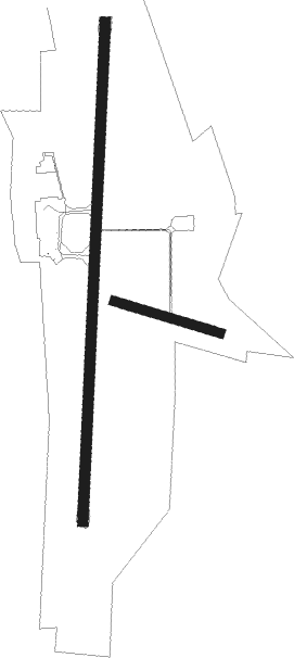
Kristianstad
Airport details
| Country | Sweden |
| State | Skåne län |
| Region | ES |
| Airspace | Sweden Ctr |
| Municipality | Kristianstads kommun |
| Elevation | 75ft (23m) |
| Timezone | GMT +1 |
| Coordinates | 55.92056, 14.08528 |
| Magnetic var | |
| Type | land |
| Available since | X-Plane v10.40 |
| ICAO code | ESMK |
| IATA code | KID |
| FAA code | n/a |
Communication
| Kristianstad Tower | 129.350 |
Approach frequencies
| ILS-cat-I | RW19 | 108.5 | 18.00mi |
| 3.2° GS | RW19 | 108.5 | 18.00mi |
Nearby beacons
| code | identifier | dist | bearing | frequency |
|---|---|---|---|---|
| KD | KRISTIANSTAD NDB | 2.9 | 188° | 375 |
| OEM | KRISTIANSTAD NDB | 4.1 | 13° | 363 |
| LJU | LJUNGBYHED VOR/DME | 31.2 | 280° | 113.40 |
| SUP | STURUP (MALMO) VOR/DME | 33.2 | 241° | 113 |
| ROE | RONNE VORTAC | 56.2 | 142° | 112 |
| VX | VAXJO NDB | 59.8 | 33° | 329 |
| FAU | FAUNA (BORNHOLM) NDB | 60.3 | 138° | 334 |
Instrument approach procedures
| runway | airway (heading) | route (dist, bearing) |
|---|---|---|
| RW01 | MK560 (334°) | MK560 2600ft MK710 (5mi, 274°) 2200ft |
| RW01 | MK720 (12°) | MK720 2600ft MK710 (5mi, 12°) 2200ft |
| RW01 | MK730 (45°) | MK730 2600ft MK710 (5mi, 94°) 2200ft |
| RNAV | MK710 2200ft MK700 (5mi, 12°) 2200ft ESMK (7mi, 13°) 127ft MK500 (7mi, 13°) KD (10mi, 191°) 2500ft KD (turn) 2500ft | |
| RW19 | MK520 (193°) | MK520 2600ft MK510 (5mi, 193°) 2200ft |
| RW19 | MK530 (226°) | MK530 2600ft MK510 (5mi, 274°) 2200ft |
| RW19 | MK840 (153°) | MK840 2600ft MK510 (5mi, 94°) 2200ft |
| RNAV | MK510 2200ft MK500 (5mi, 193°) 2200ft ESMK (7mi, 193°) 124ft MK700 (7mi, 193°) OEM (11mi, 13°) 2500ft OEM (turn) 2500ft |
Disclaimer
The information on this website is not for real aviation. Use this data with the X-Plane flight simulator only! Data taken with kind consent from X-Plane 12 source code and data files. Content is subject to change without notice.

