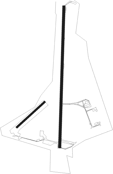
Halmstad
Airport details
| Country | Sweden |
| State | Hallands län |
| Region | ES |
| Airspace | Sweden Ctr |
| Municipality | Halmstad |
| Elevation | 101ft (31m) |
| Timezone | GMT +1 |
| Coordinates | 56.69083, 12.82000 |
| Magnetic var | |
| Type | land |
| Available since | X-Plane v10.40 |
| ICAO code | ESMT |
| IATA code | HAD |
| FAA code | n/a |
Communication
| Halmstad Tower | 130.100 |
Approach frequencies
| ILS-cat-I | RW19 | 110.1 | 18.00mi |
| 3° GS | RW19 | 110.1 | 18.00mi |
Nearby beacons
| code | identifier | dist | bearing | frequency |
|---|---|---|---|---|
| MF | HALMSTAD NDB | 2.3 | 197° | 421 |
| LT | HALMSTAD NDB | 6.4 | 12° | 336 |
| LB | ANGELHOLM NDB | 20.7 | 189° | 370 |
| AH | ANGELHOLM NDB | 25.6 | 169° | 417 |
| SVD | DME | 32.3 | 205° | 116.20 |
| LJU | LJUNGBYHED VOR/DME | 38.6 | 148° | 113.40 |
| HGG | DME | 55.8 | 330° | 113.95 |
| SL | LANDVETTER (GOTEBORG) NDB | 57.7 | 326° | 342 |
| BAK | DME | 58.7 | 316° | 112.70 |
| BEL | DME | 59.1 | 219° | 114.65 |
| LAV | LANDVETTER (GOTEBORG) VOR/DME | 60.4 | 331° | 114.60 |
Departure and arrival routes
| Transition altitude | 5000ft |
| SID end points | distance | outbound heading | |
|---|---|---|---|
| RW01 | |||
| VAKT3K | 23mi | 70° | |
| RW19 | |||
| VAKT3L | 23mi | 70° | |
| STAR starting points | distance | inbound heading | |
|---|---|---|---|
| RW01 | |||
| PELO3R | 31.2 | 240° | |
| RW19 | |||
| PELO3T | 31.2 | 240° | |
Instrument approach procedures
| runway | airway (heading) | route (dist, bearing) |
|---|---|---|
| RW01 | ABVUR (11°) | ABVUR 2600ft MT800 (3mi, 11°) 2000ft |
| RW01 | MT552 (331°) | MT552 2600ft MT800 (5mi, 273°) 2000ft |
| RW01 | MT803 (46°) | MT803 2600ft MT800 (5mi, 93°) 2000ft |
| RNAV | MT800 2000ft MT801 (5mi, 11°) 2000ft ESMT (7mi, 11°) 114ft MT502 (3mi, 11°) IRBEV (5mi, 194°) 2500ft IRBEV (turn) 2500ft | |
| RW19 | MT503 (223°) | MT503 2600ft MT500 (5mi, 273°) 2600ft |
| RW19 | MT851 (155°) | MT851 2600ft MT500 (5mi, 93°) 2600ft |
| RW19 | OSRUK (191°) | OSRUK 2600ft MT500 (4mi, 191°) 2600ft |
| RNAV | MT500 2600ft MT501 (5mi, 191°) 2600ft ESMT (8mi, 191°) 134ft MT802 (3mi, 191°) ETPUP (9mi, 12°) 2600ft ETPUP (turn) 2600ft |
Disclaimer
The information on this website is not for real aviation. Use this data with the X-Plane flight simulator only! Data taken with kind consent from X-Plane 12 source code and data files. Content is subject to change without notice.

