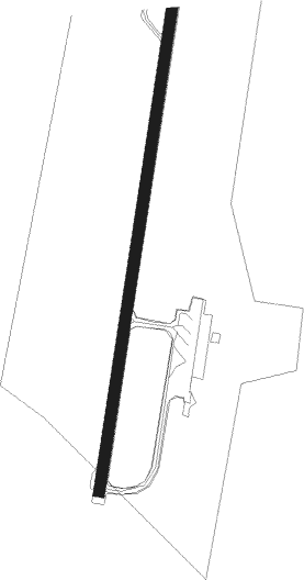
Växjö - Vaxjo Kronoberg
Airport details
| Country | Sweden |
| State | Kronoberge län |
| Region | ES |
| Airspace | Sweden Ctr |
| Municipality | Växjö |
| Elevation | 608ft (185m) |
| Timezone | GMT +1 |
| Coordinates | 56.93028, 14.72889 |
| Magnetic var | |
| Type | land |
| Available since | X-Plane v10.40 |
| ICAO code | ESMX |
| IATA code | VXO |
| FAA code | n/a |
Communication
| Vaxjo Kronoberg Tower | 118.150 |
Approach frequencies
| LOC | RW01 | 109.1 | 18.00mi |
| ILS-cat-I | RW19 | 109.7 | 18.00mi |
| 2.8° GS | RW19 | 109.7 | 18.00mi |
Nearby beacons
| code | identifier | dist | bearing | frequency |
|---|---|---|---|---|
| JX | VAXJO NDB | 4 | 23° | 349 |
| VX | VAXJO NDB | 4.5 | 203° | 329 |
| LP | RONNEBY NDB | 39.9 | 137° | 318 |
| RON | DME | 44.2 | 142° | 109.20 |
| LF | RONNEBY NDB | 47.3 | 145° | 380 |
| OJ | JONKOPING NDB | 51.2 | 318° | 403 |
| JON | JONKOPING VOR/DME | 54.2 | 321° | 115.80 |
| OA | JONKOPING NDB | 57.4 | 325° | 338 |
| OEM | KRISTIANSTAD NDB | 60.2 | 214° | 363 |
Instrument approach procedures
| runway | airway (heading) | route (dist, bearing) |
|---|---|---|
| RW01 | MX565 (342°) | MX565 2800ft DIMGA (5mi, 277°) 2600ft |
| RW01 | MX751 (53°) | MX751 2800ft DIMGA (5mi, 97°) 2600ft |
| RW01 | MX752 (23°) | MX752 2800ft DIMGA (4mi, 23°) 2600ft |
| RNAV | DIMGA 2600ft MX750 (5mi, 23°) 2600ft ESMX (7mi, 23°) 660ft MX400 (6mi, 23°) OSVEM (8mi, 245°) 2600ft OSVEM (turn) 2600ft | |
| RW19 | MX531 (233°) | MX531 2800ft IBTOX (5mi, 277°) 2600ft |
| RW19 | MX532 (203°) | MX532 2800ft IBTOX (4mi, 203°) 2600ft |
| RW19 | MX850 (162°) | MX850 2800ft IBTOX (5mi, 97°) 2600ft |
| RNAV | IBTOX 2600ft MX530 (5mi, 203°) 2600ft ESMX (7mi, 203°) 613ft MX800 (6mi, 203°) OSVEM (7mi, 313°) 2600ft OSVEM (turn) 2600ft |
Disclaimer
The information on this website is not for real aviation. Use this data with the X-Plane flight simulator only! Data taken with kind consent from X-Plane 12 source code and data files. Content is subject to change without notice.
