Airports for X-Plane offers a convenient way to explore airports and their related communication information for the X-Plane flight simulator. It only uses data from the X-Plane flight simulator itself, and is therefore more reliable than the data that comes from real aviation websites. You can search for airports by using the ICAO code, or browse for airports per country and state. The information displayed is categorized by airport details, runway information, airport communication, approach frequencies (ILS and Glidepath details), details of nearby beacons, SIDs, STARs and approach procedures.

road arriving concrete local government southwest airspeed warfare pilot airport authority embassy frankfurt airport train station air traffic control stol airports airdock airfield traffic pattern traffic buildings automated airport weather station

Smålandsstenar - Smalandsstenar Smalanda

Airport details

CountrySweden
StateJönköpings län
RegionES
AirspaceSweden Ctr
MunicipalityGislaveds kommun
Elevation540ft (165m)
TimezoneGMT +1
Coordinates57.16861, 13.44000
Magnetic var
Typeland
Available sinceX-Plane v10.40
ICAO codeESMY
IATA coden/a
FAA coden/a

Communication

No airport communication available for ESMY
Nearby Points of Interest:
Smålandsstenars kyrka
-
Villstads kyrka
-
Reftele socken
-
Sm 50 M
-
Burseryds socken
-
Kållerstads socken
-
Södra Hestra socken
-
Jälluntofta kyrka
-
Jälluntofta socken
-
Långaryds socken
-
Våthults socken
-
Våthults kyrka
-
Bosebo socken
-
Ås socken
-
Sandviks socken
-
Anderstorp socken
-
Bredaryd socken
-
Gryteryds socken
-
Båraryds socken
-
Färgaryds socken
-
Sm 52, Forsheda allmänning
-
Sjötofta socken
-
Kulltorps socken
-
Kulltorps kyrka
-
Torskinge socken

Runway info

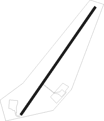
Runway 04 / 22
 length799m (2621ft)
 bearing56° / 236°
 width15m (49ft)
 surfaceasphalt
 displ threshold107m (351ft) / 135m (443ft)

Airport layout


Nearby beacons

codeidentifierdistbearingfrequency
LTHALMSTAD NDB29.6238°336
OJJONKOPING NDB3748°403
MFHALMSTAD NDB37.2231°421
SDHDME40.4315°115.65
JONJONKOPING VOR/DME40.847°115.80
OAJONKOPING NDB45.146°338
LBANGELHOLM NDB54.1219°370
AHANGELHOLM NDB57211°417
SVDDME66.4221°116.20

Disclaimer

The information on this website is not for real aviation. Use this data with the X-Plane flight simulator only! Data taken with kind consent from X-Plane 12 source code and data files. Content is subject to change without notice.