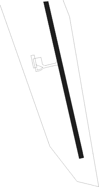
Kramfors / Sollefteå - Kramfors Solleftea
Airport details
| Country | Sweden |
| State | Västernorrlands län |
| Region | ES |
| Airspace | Sweden Ctr |
| Municipality | Torsåker District |
| Elevation | 32ft (10m) |
| Timezone | GMT +1 |
| Coordinates | 63.04861, 17.76889 |
| Magnetic var | |
| Type | land |
| Available since | X-Plane v10.40 |
| ICAO code | ESNK |
| IATA code | KRF |
| FAA code | n/a |
Communication
| Kramfors Solleftea AFIS | 122.150 |
Approach frequencies
| LOC | RW17 | 109.3 | 18.00mi |
| ILS-cat-I | RW35 | 109.7 | 18.00mi |
| 3.2° GS | RW35 | 109.7 | 18.00mi |
Nearby beacons
| code | identifier | dist | bearing | frequency |
|---|---|---|---|---|
| KG | KRAMFORS-SOLLEFTEA NDB | 4.5 | 340° | 326 |
| LUE | LUNDE NDB | 10.2 | 161° | 427 |
| SUN | SUNDSVALL VOR/DME | 32.4 | 212° | 113.10 |
Instrument approach procedures
| runway | airway (heading) | route (dist, bearing) |
|---|---|---|
| RW17 | NK500 (207°) | NK500 3000ft NK851 (5mi, 266°) 2900ft |
| RW17 | NK852 (128°) | NK852 3300ft NK851 (5mi, 86°) 2900ft |
| RW17 | NK853 (162°) | NK853 3300ft NK851 (3mi, 162°) 2900ft |
| RNAV | NK851 2900ft NK850 (4mi, 162°) 2900ft ESNK (9mi, 162°) 85ft NK554 (6mi, 162°) LOFER (10mi, 342°) 3300ft LOFER (turn) 3300ft | |
| RW35 | NK552 (309°) | NK552 3000ft NK551 (5mi, 266°) 3000ft |
| RW35 | NK553 (342°) | NK553 3200ft NK551 (3mi, 342°) 3000ft |
| RW35 | NK700 (26°) | NK700 3300ft NK551 (5mi, 86°) 3000ft |
| RNAV | NK551 3000ft NK550 (4mi, 342°) 3000ft ESNK (9mi, 342°) 74ft NK850 (9mi, 342°) LOFER (4mi, 162°) 3300ft LOFER (turn) 3300ft |
Disclaimer
The information on this website is not for real aviation. Use this data with the X-Plane flight simulator only! Data taken with kind consent from X-Plane 12 source code and data files. Content is subject to change without notice.
