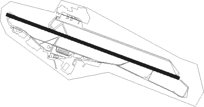
Östersund - Are Ostersund
Airport details
| Country | Sweden |
| State | Jämtlande län |
| Region | ES |
| Airspace | Sweden Ctr |
| Municipality | Östersund |
| Elevation | 1229ft (375m) |
| Timezone | GMT +1 |
| Coordinates | 63.19444, 14.50028 |
| Magnetic var | |
| Type | land |
| Available since | X-Plane v10.32 |
| ICAO code | ESNZ |
| IATA code | OSD |
| FAA code | n/a |
Communication
| Are Ostersund Tower | 135.650 |
| Are Ostersund Tower | 130.900 |
| Are Ostersund Östersund Tower | 135.655 |
Approach frequencies
| ILS-cat-III | RW12 | 109.5 | 18.00mi |
| 3° GS | RW12 | 109.5 | 18.00mi |
Nearby beacons
| code | identifier | dist | bearing | frequency |
|---|---|---|---|---|
| OSS | OSTERSUND VOR/DME | 0.4 | 292° | 114.65 |
| DJ | OSTERSUND NDB | 2.4 | 101° | 312 |
Departure and arrival routes
| Transition altitude | 6000ft |
| SID end points | distance | outbound heading | |
|---|---|---|---|
| RW12 | |||
| NONK1K | 16mi | 45° | |
| BENK4B, BENK2G, BENK1K | 26mi | 83° | |
| ULTE1K | 28mi | 102° | |
| OSLA1K, OSLA2G | 34mi | 124° | |
| DIGL1K | 20mi | 194° | |
| RW30 | |||
| NONK1L | 16mi | 45° | |
| BENK1L | 26mi | 83° | |
| ULTE1L | 28mi | 102° | |
| OSLA1L | 34mi | 124° | |
| DIGL1L | 20mi | 194° | |
| STAR starting points | distance | inbound heading | |
|---|---|---|---|
| RW12 | |||
| DOFO1H, DOFO1S | 29.1 | 5° | |
| BENK5E | 25.5 | 263° | |
| OSLA1H, OSLA3S, OSLA5E | 33.7 | 304° | |
| RW30 | |||
| DIGL1T | 19.6 | 14° | |
| NONK1T | 16.0 | 225° | |
| BENK6F, BENK1T | 25.5 | 263° | |
| ULTE1T | 27.9 | 282° | |
| OSLA1T, OSLA6F | 33.7 | 304° | |
Instrument approach procedures
| runway | airway (heading) | route (dist, bearing) |
|---|---|---|
| RW12-Y | NZ704 (47°) | NZ704 NZ700 (5mi, 336°) 3800ft |
| RW12-Y | NZ705 (27°) | NZ705 NZ700 (5mi, 294°) 3800ft |
| RNAV | NZ700 3800ft NZ702 (3mi, 344°) 3440ft NZ950 (4mi, 72°) ESNZ (3mi, 102°) 1245ft NZ595 (6mi, 102°) NZ402 (6mi, 46°) ESULO (8mi, 282°) ESULO (turn) 3600ft | |
| RW12-Z | NZ856 (102°) | NZ856 4900ft NZ855 (4mi, 101°) 2800ft |
| RW12-Z | NZ857 (118°) | NZ857 3700ft NZ855 (5mi, 225°) 2800ft |
| RNAV | NZ855 2800ft NZ902 (5mi, 102°) 2800ft ESNZ (6mi, 102°) 1244ft NZ595 (6mi, 102°) ESULO (10mi, 313°) 3600ft ESULO (turn) 3600ft | |
| RW30 | OSLAV (304°) | OSLAV NZ690 (15mi, 320°) 6000ft NZ691 (4mi, 320°) 3600ft NZ623 (7mi, 326°) 3600ft |
| RNAV | NZ623 3600ft NZ624 (3mi, 282°) 3600ft ESNZ (8mi, 282°) 1283ft (3850mi, 193°) 3600ft DJ (3850mi, 13°) 3600ft |
Disclaimer
The information on this website is not for real aviation. Use this data with the X-Plane flight simulator only! Data taken with kind consent from X-Plane 12 source code and data files. Content is subject to change without notice.
