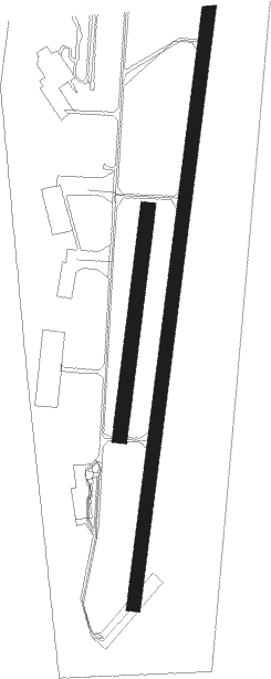
Stockholm / Västerås - Vasteras
Airport details
| Country | Sweden |
| State | Västmanlanda län |
| Region | ES |
| Airspace | Sweden Ctr |
| Municipality | Västerås |
| Elevation | 20ft (6m) |
| Timezone | GMT +1 |
| Coordinates | 59.58944, 16.63361 |
| Magnetic var | |
| Type | land |
| Available since | X-Plane v10.40 |
| ICAO code | ESOW |
| IATA code | VST |
| FAA code | n/a |
Communication
| Vasteras Tower | 130.600 |
| Vasteras CON | 125.950 |
Approach frequencies
| ILS-cat-I | RW19 | 108.3 | 18.00mi |
| 3° GS | RW19 | 108.3 | 18.00mi |
Nearby beacons
| code | identifier | dist | bearing | frequency |
|---|---|---|---|---|
| ARS | AROS VOR/DME | 0.5 | 101° | 112.80 |
| RD | VAESTERAAS AB (STOCKHOLM) NDB | 4.4 | 202° | 419 |
| LE | VAESTERAAS AB (STOCKHOLM) NDB | 4.5 | 22° | 333 |
| LX | ESKILSTUNA NDB | 19 | 166° | 402 |
| LNA | LENA NDB | 22.2 | 94° | 330 |
| COR | CORNER NDB | 32.6 | 111° | 388 |
| TRS | TROSA VOR/DME | 47.3 | 127° | 114.30 |
| NW | SKAVSTA (STOCKHOLM) NDB | 48.5 | 170° | 364 |
| PEO | SKAVSTA (STOCKHOLM) NDB | 49.2 | 153° | 398 |
Instrument approach procedures
| runway | airway (heading) | route (dist, bearing) |
|---|---|---|
| RW01 | OW610 (346°) | OW610 2500ft EPITA (4mi, 276°) 2500ft |
| RW01 | OW840 (49°) | OW840 2500ft EPITA (4mi, 96°) 2500ft |
| RNAV | EPITA 2500ft OW801 (4mi, 22°) 2500ft ESOW (8mi, 22°) 65ft ESOW (turn) 2500ft TIXES (4mi, 123°) 2500ft TIXES (turn) 2500ft | |
| RW19 | OW540 (228°) | OW540 2500ft NOLGI (4mi, 276°) 2500ft |
| RNAV | NOLGI 2500ft OW519 (4mi, 202°) 2500ft ESOW (8mi, 202°) 72ft ESOW (turn) 2500ft TIXES (4mi, 123°) 2500ft TIXES (turn) 2500ft |
Disclaimer
The information on this website is not for real aviation. Use this data with the X-Plane flight simulator only! Data taken with kind consent from X-Plane 12 source code and data files. Content is subject to change without notice.

