Arboga
Airport details
| Country | Sweden |
| State | Västmanlands län |
| Region | ES |
| Airspace | Sweden Ctr |
| Municipality | Arboga kommun |
| Elevation | 32ft (10m) |
| Timezone | GMT +1 |
| Coordinates | 59.38833, 15.92083 |
| Magnetic var | |
| Type | land |
| Available since | X-Plane v10.32 |
| ICAO code | ESQO |
| IATA code | n/a |
| FAA code | n/a |
Communication
Nearby Points of Interest:
Arboga socken
-Arboga stad
-Björskog
-Jäders bruk
-Kungs-Barkarö socken
-Kung Karls socken
-Södermanlands runinskrifter 336
-Medåkers socken
-Himmeta socken
-Himmeta kyrka
-Bro kyrka
-Västermo socken
-Nyströmska gården
-Köping
-Götlunda socken
-Närkes runinskrifter 32
-Södermanland Runic Inscription 86
-Torpa socken
-Närkes runinskrifter 31
-Köpings socken
-Öja socken
-Valsta säteri
-Munktorps socken
-Fellingsbro socken
-Lista socken
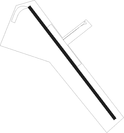
Runway info
| Runway 15 / 33 | ||
| length | 1995m (6545ft) | |
| bearing | 128° / 308° | |
| width | 40m (131ft) | |
| surface | concrete | |
| displ threshold | 0m (0ft) / 300m (984ft) | |
Nearby beacons
| code | identifier | dist | bearing | frequency |
|---|---|---|---|---|
| RD | VAESTERAAS AB (STOCKHOLM) NDB | 22.2 | 79° | 419 |
| LX | ESKILSTUNA NDB | 25.1 | 98° | 402 |
| ARS | AROS VOR/DME | 25.2 | 75° | 112.80 |
| EN | OREBRO NDB | 26.8 | 264° | 400 |
| LE | VAESTERAAS AB (STOCKHOLM) NDB | 27.9 | 70° | 333 |
| RB | OREBRO NDB | 32 | 255° | 375 |
| NW | SKAVSTA (STOCKHOLM) NDB | 44.9 | 125° | 364 |
| ON | NORRKOPING NDB | 50.3 | 150° | 324 |
| SC | SAAB (LINKOPING) NDB | 58.5 | 201° | 300 |
Disclaimer
The information on this website is not for real aviation. Use this data with the X-Plane flight simulator only! Data taken with kind consent from X-Plane 12 source code and data files. Content is subject to change without notice.