Airports for X-Plane offers a convenient way to explore airports and their related communication information for the X-Plane flight simulator. It only uses data from the X-Plane flight simulator itself, and is therefore more reliable than the data that comes from real aviation websites. You can search for airports by using the ICAO code, or browse for airports per country and state. The information displayed is categorized by airport details, runway information, airport communication, approach frequencies (ILS and Glidepath details), details of nearby beacons, SIDs, STARs and approach procedures.

asphalt arriving airport authority seaplanes arrival airspace airborne faa international stol jetliner passenger hangar kennedy buildings airport check-in landing area air terminal capital government

Eskilstuna - Eskilstuna Ekeby

Airport details

CountrySweden
StateSödermanlands län
RegionES
AirspaceSweden Ctr
MunicipalityEskilstuna
Elevation42ft (13m)
TimezoneGMT +1
Coordinates59.38389, 16.44194
Magnetic var
Typeland
Available sinceX-Plane v10.40
ICAO codeESSC
IATA coden/a
FAA coden/a

Communication

No airport communication available for ESSC
Nearby Points of Interest:
Torshälla socken
-
Mariakyrkan
-
Stenby fornborg
-
Eskilstuna
-
Vattenpalatset, Eskilstuna
-
Torshälla stad
-
Torshälla kvarn
-
Rinkesta
-
Sankt Pauli kyrka, Eskilstuna
-
Södermanland Runic Inscription 109
-
Södermanlands runinskrifter 108
-
Södermanlands runinskrifter 107
-
Södermanlands runinskrifter 119
-
Södermanlands runinskrifter 91
-
Sö 82
-
Södermanland Runic Inscription 84
-
Tumbo socken
-
Södermanlands runinskrifter 362
-
Sö 83
-
Södermanlands runinskrifter 363
-
Husby-Rekarne socken
-
Södermanland Runic Inscription 92
-
Råby-Rekarne socken
-
Vallby socken
-
Sö 90

Runway info

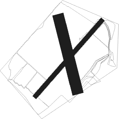
Runway 05 / 23  
 length904m (2966ft)
 bearing64° / 244°
 width40m (131ft)
 surfacegrass
Runway 17 / 35  
 length645m (2116ft)
 bearing162° / 342°
 width100m (328ft)
 surfacegrass

Airport layout


Nearby beacons

codeidentifierdistbearingfrequency
RDVAESTERAAS AB (STOCKHOLM) NDB9.451°419
LXESKILSTUNA NDB10.5112°402
ARSAROS VOR/DME13.746°112.80
LEVAESTERAAS AB (STOCKHOLM) NDB1838°333
LNALENA NDB29.480°330
NWSKAVSTA (STOCKHOLM) NDB37.4151°364
PEOSKAVSTA (STOCKHOLM) NDB39.8134°398
ONNORRKOPING NDB48184°324
SCSAAB (LINKOPING) NDB63.4223°300

Disclaimer

The information on this website is not for real aviation. Use this data with the X-Plane flight simulator only! Data taken with kind consent from X-Plane 12 source code and data files. Content is subject to change without notice.