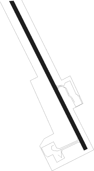
Torsby
Airport details
| Country | Sweden |
| State | Värmlanda län |
| Region | ES |
| Airspace | Sweden Ctr |
| Municipality | Torsby kommun |
| Elevation | 393ft (120m) |
| Timezone | GMT +1 |
| Coordinates | 60.15472, 12.99361 |
| Magnetic var | |
| Type | land |
| Available since | X-Plane v10.40 |
| ICAO code | ESST |
| IATA code | TYF |
| FAA code | n/a |
Communication
| Torsby AFIS | 122.050 |
Approach frequencies
| LOC | RW16 | 108.7 | 18.00mi |
| LOC | RW34 | 110.9 | 18.00mi |
Nearby beacons
| code | identifier | dist | bearing | frequency |
|---|---|---|---|---|
| TY | TORSBY NDB | 3.6 | 142° | 384 |
| TH | TORSBY NDB | 7 | 319° | 402 |
| HT | HAGFORS NDB | 17.3 | 94° | 345 |
| AB | HAGFORS NDB | 21.5 | 109° | 393 |
| NKS | KARLSTAD NDB | 39.5 | 146° | 341 |
| KSD | KARLSTAD VOR/DME | 43.9 | 155° | 117.80 |
| SKS | KARLSTAD NDB | 47.4 | 160° | 330 |
Instrument approach procedures
| runway | airway (heading) | route (dist, bearing) |
|---|---|---|
| RW16 | IDMUK (119°) | IDMUK 3300ft ST850 (4mi, 78°) 2800ft |
| RW16 | OLGOL (140°) | OLGOL 3600ft ST850 (4mi, 140°) 2800ft |
| RW16 | XENBU (174°) | XENBU 3400ft ST850 (4mi, 258°) 2800ft |
| RNAV | ST850 2800ft LEBTU (6mi, 140°) 2800ft ESST (7mi, 140°) 400ft ST550 (4mi, 141°) LEBTU (11mi, 321°) 3000ft LEBTU (turn) 3000ft | |
| RW34 | GIXAK (360°) | GIXAK 3000ft ST551 (4mi, 78°) 2300ft |
| RW34 | RETGU (321°) | RETGU 3300ft ST551 (4mi, 321°) 2300ft |
| RW34 | UVTUK (297°) | UVTUK 3400ft ST551 (4mi, 259°) 2300ft |
| RNAV | ST551 2300ft ST552 (5mi, 321°) 2300ft ESST (6mi, 321°) 444ft LEBTU (7mi, 320°) 3000ft LEBTU (turn) 3000ft |
Disclaimer
The information on this website is not for real aviation. Use this data with the X-Plane flight simulator only! Data taken with kind consent from X-Plane 12 source code and data files. Content is subject to change without notice.
