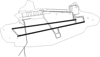
Ramstein - Ramstein Ab
Airport details
| Country | Germany |
| State | Rhineland-Palatinate |
| Region | ED |
| Airspace | Langen Ctr |
| Municipality | Ramstein-Miesenbach |
| Elevation | 775ft (236m) |
| Timezone | GMT +1 |
| Coordinates | 49.43616, 7.60650 |
| Magnetic var | |
| Type | land |
| Available since | X-Plane v10.40 |
| ICAO code | ETAR |
| IATA code | RMS |
| FAA code | n/a |
Communication
| Ramstein AB Ramstein ATIS | 124.275 |
| Ramstein AB Ramstein tower | 133.200 |
Approach frequencies
| ILS-cat-III | RW26 | 110.5 | 18.00mi |
| ILS-cat-I | RW09 | 111.5 | 18.00mi |
| ILS-cat-I | RW08 | 108.95 | 18.00mi |
| ILS-cat-I | RW27 | 110.75 | 18.00mi |
| 3° GS | RW09 | 111.5 | 18.00mi |
| 3° GS | RW08 | 108.95 | 18.00mi |
| 3° GS | RW26 | 110.5 | 18.00mi |
| 3° GS | RW27 | 110.75 | 18.00mi |
Nearby beacons
| code | identifier | dist | bearing | frequency |
|---|---|---|---|---|
| RMS | RAMSTEIN TACAN | 0.8 | 266° | 113.40 |
| ZWN | ZWEIBRUECKEN VOR/DME | 14.4 | 222° | 114.80 |
| SR | ENSHEIM (SAARBRUECKEN) NDB | 20 | 241° | 360 |
| SAD | DME | 23.4 | 245° | 116.75 |
| FHH | DME | 33.1 | 326° | 117.35 |
| HAN | HAHN NDB | 34.1 | 328° | 376 |
| MND | DME | 35.5 | 88° | 113.55 |
| SAV | SAVERNE VOR/DME | 38.9 | 194° | 110.45 |
| RID | RIED VOR/DME | 41.8 | 70° | 112.20 |
| KBA | KARLSRUHE/BADEN-BADEN NDB | 42.9 | 142° | 431 |
| PHG | PHALSBOURG NDB | 43.2 | 211° | 424 |
| KBD | DME | 43.7 | 144° | 115.80 |
| GTQ | GROSTENQUIN VOR/DME | 44.1 | 243° | 111.25 |
| WIB | WIESBADEN TACAN | 45.7 | 49° | 114.10 |
| VFM | NAUHEIM VOR | 46 | 59° | 113.75 |
| KRH | KARLSRUHE VOR/DME | 46.6 | 114° | 115.95 |
| FW | FRANKFURT NDB | 46.7 | 55° | 382 |
| SPA | SPANGDAHLEM TACAN | 48 | 301° | 109.50 |
| BUE | BUECHEL TACAN | 49.2 | 324° | 117.10 |
| SE | STRASBOURG NDB | 51 | 173° | 412 |
| FRD | DME | 51.6 | 58° | 115.90 |
| TAU | TAUNUS VOR/DME | 53.4 | 34° | 113.35 |
| STR | STRASBOURG ENTZHEIM VOR/DME | 55.9 | 182° | 115.60 |
Departure and arrival routes
| Transition altitude | 5000ft |
| SID end points | distance | outbound heading | |
|---|---|---|---|
| RW08 | |||
| BOLK2E | 41mi | 96° | |
| BOLK2S | 40mi | 114° | |
| BOLKI2, BOLK2W | 23mi | 246° | |
| BOLK2L | 53mi | 279° | |
| BOLK2N | 43mi | 308° | |
| RW09 | |||
| BOLK2E | 41mi | 96° | |
| BOLK2S | 40mi | 114° | |
| BOLKI2, BOLK2W | 23mi | 246° | |
| BOLK2L | 53mi | 279° | |
| BOLK2N | 43mi | 308° | |
| RW26 | |||
| TOLE2E | 41mi | 96° | |
| TOLE2S | 40mi | 114° | |
| TOLE2W | 23mi | 246° | |
| TOLE2L | 53mi | 279° | |
| TOLE2N | 43mi | 308° | |
| RW27 | |||
| TOLE2E | 41mi | 96° | |
| TOLE2S | 40mi | 114° | |
| TOLE2W | 23mi | 246° | |
| TOLE2L | 53mi | 279° | |
| TOLE2N | 43mi | 308° | |
Instrument approach procedures
| runway | airway (heading) | route (dist, bearing) |
|---|---|---|
| RW08 | MAPIG (91°) | MAPIG 5000ft INBUG (8mi, 104°) 4000ft |
| RNAV | INBUG 4000ft RIPOX (7mi, 85°) 3000ft ETAR (8mi, 85°) 813ft (2995mi, 189°) 1181ft XIDOD (2999mi, 9°) 5000ft XIDOD (turn) 13500ft | |
| RW09 | MAPIG (91°) | MAPIG 5000ft XAXAP (8mi, 98°) 4000ft |
| RNAV | XAXAP 4000ft IPTUD (7mi, 87°) 3000ft TEQUI (4mi, 87°) 1700ft ETAR (4mi, 88°) 813ft (2995mi, 189°) 1181ft XIDOD (2999mi, 9°) 5000ft XIDOD (turn) 13500ft | |
| RW26 | XIDOD (268°) | XIDOD 5000ft TIBTO (4mi, 274°) 4000ft |
| RNAV | TIBTO 4000ft SUDUB (6mi, 265°) 2700ft ETAR (6mi, 265°) 828ft (2995mi, 189°) 1181ft MAPIG (2992mi, 8°) 5000ft MAPIG (turn) 13500ft | |
| RW27 | XIDOD (268°) | XIDOD 5000ft UMRET (4mi, 267°) 4000ft |
| RNAV | UMRET 4000ft OGNID (6mi, 268°) 2700ft ETAR (6mi, 267°) 835ft (2995mi, 189°) 1181ft MAPIG (2992mi, 8°) 5000ft MAPIG (turn) 13500ft |
Disclaimer
The information on this website is not for real aviation. Use this data with the X-Plane flight simulator only! Data taken with kind consent from X-Plane 12 source code and data files. Content is subject to change without notice.

