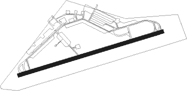
Bueckeburg Ab
Airport details
| Country | Germany |
| State | Lower Saxony |
| Region | ED |
| Airspace | Bremen Ctr |
| Municipality | Bückeburg |
| Elevation | 229ft (70m) |
| Timezone | GMT +1 |
| Coordinates | 52.27926, 9.07991 |
| Magnetic var | |
| Type | land |
| Available since | X-Plane v10.40 |
| ICAO code | ETHB |
| IATA code | n/a |
| FAA code | n/a |
Communication
| Bueckeburg AB Bueckeburg tower | 122.100 |
Approach frequencies
| ILS-cat-I | RW26 | 111.55 | 18.00mi |
| 3.2° GS | RW26 | 111.55 | 18.00mi |
Nearby Points of Interest:
Schloss Arensburg
-Kalkofen Timmerberg
-Altes Rathaus (Stadthagen)
-Langer Jammer
-Old bridge of Wasserstraßenkreuz Minden
-Stadtvilla Noll
-Stadtvilla Köhler
-Berliner Kilometerstein
-St Johannis
-Alte Regierung Minden
-Windloch
-Bürgerschule III in Minden
-Brüderhof Minden
-Erbpachtmühle Langenholzhausen
-Rathaus Sachsenhagen
-Windmühle Bentorf
-Hülsede Water Castle
-Haus Malz
-Schule
-Amtsgericht Bad Oeynhausen
-St. Magnuskirche
-Großsteingrab von Werste
-house with mikwe
-Alte Taufe
-Schloss Bokeloh
Runway info
| Runway 08 / 26 | ||
| length | 1820m (5971ft) | |
| bearing | 82° / 262° | |
| width | 45m (148ft) | |
| surface | asphalt | |
| displ threshold | 158m (518ft) / 0m (0ft) | |
Nearby beacons
| code | identifier | dist | bearing | frequency |
|---|---|---|---|---|
| BYC | BUECKEBURG NDB | 0.8 | 43° | 368 |
| WUN | WUNSTORF TACAN | 16.5 | 63° | 114.85 |
| HW | HANNOVER NDB | 20.5 | 68° | 358 |
| NIE | NIENBURG VOR | 23.4 | 40° | 116.50 |
| HBD | DME | 23.7 | 73° | 116.90 |
| HAD | DME | 25.2 | 73° | 113.95 |
| HA | HANNOVER NDB | 28.8 | 76° | 320 |
| DLE | LEINE VOR/DME | 29.5 | 92° | 115.20 |
| OSB | OSNABRUCK TACAN | 29.5 | 264° | 108.35 |
| OSN | OSNABRUECK VOR | 29.5 | 264° | 114.30 |
| DP | DIEPHOLZ NDB | 29.6 | 297° | 325 |
| SAS | SARSTEDT VOR/DME | 29.6 | 92° | 114.45 |
| CEL | CELLE NDB | 39.4 | 72° | 311 |
| PAD | PADERBORN-LIPPSTADT NDB | 42.6 | 214° | 354 |
| PAD | DME-ILS | 43.6 | 215° | 108.50 |
| WRB | WARBURG VOR/DME | 46.4 | 178° | 113.70 |
| HIG | BREMEN NDB | 46.6 | 347° | 318 |
| BND | DME | 47.1 | 339° | 113.65 |
| BMN | BREMEN VOR/DME | 47.5 | 337° | 117.45 |
| DKS | DME-ILS | 52.9 | 159° | 111.50 |
Departure and arrival routes
| Transition altitude | 5000ft |
| SID end points | distance | outbound heading | |
|---|---|---|---|
| RW08 | |||
| HB31 | 30mi | 264° | |
| RW26 | |||
| HB11 | 30mi | 264° | |
| HB12 | 11mi | 288° | |
Instrument approach procedures
| runway | airway (heading) | route (dist, bearing) |
|---|---|---|
| RW08 | PEKUV (70°) | PEKUV HB400 (4mi, 340°) 3000ft |
| RW08 | UBOBU (93°) | UBOBU HB400 (4mi, 160°) 3000ft |
| RNAV | HB400 3000ft TAKAX (4mi, 82°) 3000ft ETHB (9mi, 82°) 274ft HB410 (3mi, 83°) HB411 (1mi, 62°) HB412 (3mi, 31°) UBOBU (18mi, 264°) 4000ft | |
| RW26 | BYC (223°) | BYC HB450 (6mi, 123°) 3000ft HB451 (5mi, 86°) 3000ft HB452 (4mi, 5°) 3000ft |
| RW26 | VABMA (296°) | VABMA HB451 (4mi, 5°) 3000ft HB452 (4mi, 5°) 3000ft |
| RNAV | HB452 3000ft XALOR (4mi, 272°) 2000ft ETHB (6mi, 263°) 262ft HB460 (2mi, 261°) HB461 (2mi, 316°) HB462 (4mi, 49°) HB463 (2mi, 104°) BYC (3mi, 194°) 3000ft |
Disclaimer
The information on this website is not for real aviation. Use this data with the X-Plane flight simulator only! Data taken with kind consent from X-Plane 12 source code and data files. Content is subject to change without notice.