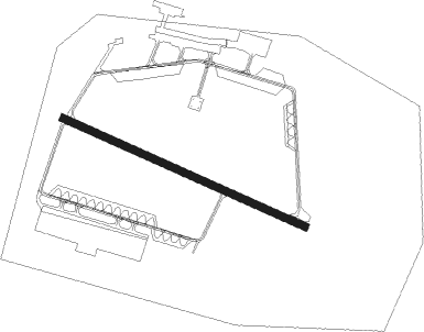
Fritzlar - Fritzlar Ab
Airport details
| Country | Germany |
| State | Hesse |
| Region | ED |
| Airspace | Langen Ctr |
| Municipality | Fritzlar |
| Elevation | 564ft (172m) |
| Timezone | GMT +1 |
| Coordinates | 51.11696, 9.28680 |
| Magnetic var | |
| Type | land |
| Available since | X-Plane v10.40 |
| ICAO code | ETHF |
| IATA code | FRZ |
| FAA code | n/a |
Communication
| Fritzlar AB Fritzlar Tower | 122.100 |
| Fritzlar AB Fritzlar Radar | 135.600 |
Nearby Points of Interest:
Johanneskirche (Arnsbach)
-Mader Heide
-Ringwallanlagen Odenberg
-Evangelische Kirche Altwildungen
-Wallburg Großenritte
-Bahnhof Baunatal-Großenritte
-Evangelische Kirche Kirchbauna
-Schloss Melsungen
-Altenstädter Warte
-Kirche Allendorf an der Landsburg
-Evangelische Kirche Battenhausen
-Menhir von Wellen
-Ziegenhain fortress
-Heilig-Geist-Hospital Treysa
-Elfbuchenturm
-Gräfestraße 16
-Wilhelmshöher Allee 118
-Stadthalle Kassel
-Dörnbergstraße 2 (Kassel)
-Frühstückspavillon
-Ständehaus Kassel
-Zwehrenturm
-Elisabethhospital (Kassel)
-Palais Reichenbach
-Henschelhaus
Nearby beacons
| code | identifier | dist | bearing | frequency |
|---|---|---|---|---|
| FTZ | FRITZLAR NDB | 5.2 | 104° | 468 |
| DKS | DME-ILS | 18.8 | 21° | 111.50 |
| WRB | WARBURG VOR/DME | 24.2 | 336° | 113.70 |
| FUL | FULDA VOR/DME | 33.3 | 151° | 112.10 |
| PAD | DME-ILS | 38.7 | 306° | 108.50 |
| PAD | PADERBORN-LIPPSTADT NDB | 38.9 | 308° | 354 |
| GED | GEDERN VORTAC | 42.3 | 183° | 110.80 |
| MTR | METRO VOR | 53.1 | 208° | 110 |
Instrument approach procedures
| runway | airway (heading) | route (dist, bearing) |
|---|---|---|
| RW30 | KEMAD (269°) | KEMAD 5000ft HF402 (8mi, 221°) 3300ft |
| RW30 | RANIN (3°) | RANIN 5000ft HF401 (9mi, 86°) 3600ft HF402 (5mi, 46°) 3300ft |
| RNAV | HF402 3300ft HF403 (5mi, 289°) 3300ft ETHF (8mi, 290°) 608ft (3106mi, 190°) 1700ft RANIN (3095mi, 10°) 5000ft |
Disclaimer
The information on this website is not for real aviation. Use this data with the X-Plane flight simulator only! Data taken with kind consent from X-Plane 12 source code and data files. Content is subject to change without notice.