Laupheim - Laupheim Air Base
Airport details
| Country | Germany |
| State | Baden-Württemberg |
| Region | ED |
| Airspace | Munich Ctr |
| Municipality | Laupheim |
| Elevation | 1765ft (538m) |
| Timezone | GMT +1 |
| Coordinates | 48.22181, 9.91148 |
| Magnetic var | |
| Type | land |
| Available since | X-Plane v10.40 |
| ICAO code | ETHL |
| IATA code | n/a |
| FAA code | n/a |
Communication
Nearby Points of Interest:
Namen-Jesu-Kirche
-Unserer lieben Frau auf dem Kapf
-Wallfahrtskirche St. Simon und Judas Thaddäus
-Gottesackerkapelle zum Heiligen Kreuz
-Ständehaus
-Pfarrkirche St. Michael
-Gigelberghalle
-Mariä Geburt
-rectory
-Altes Rathaus
-Roter Bau
-Marienkapelle
-St. Vitus
-Söflingen Abbey
-Marienkapelle Oberstetten
-Ulmer Münz
-Reichenauer Hof
-Stadthaus Ulm
-Bruder-Klaus-Kapelle
-St. Johannes Baptista
-Burgus Finningen
-Burg Klingenstein
-Gasthaus zum Rößle (Schelklingen)
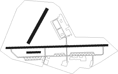
Runway info
Runway 09 / 27  | ||
| length | 1645m (5397ft) | |
| bearing | 92° / 272° | |
| width | 30m (98ft) | |
| surface | asphalt | |
| Runway 09R / 27L | ||
| length | 200m (656ft) | |
| bearing | 92° / 272° | |
| width | 30m (98ft) | |
| surface | grass | |
| Runway 03 / 21 | ||
| length | 604m (1982ft) | |
| bearing | 45° / 225° | |
| width | 50m (164ft) | |
| surface | grass | |
Nearby beacons
| code | identifier | dist | bearing | frequency |
|---|---|---|---|---|
| LUP | LAUPHEIM NDB | 0.2 | 182° | 407 |
| ALD | (MEMMINGEN/ALLGAU) DME | 18.9 | 126° | 117.20 |
| ALG | ALLGAEU (MEMMINGEN) NDB | 19.4 | 123° | 341 |
| KPT | KEMPTEN VOR/DME | 33.5 | 137° | 108.40 |
| TGO | TANGO TACAN | 35.2 | 301° | 112.50 |
| FHD | DME | 37 | 216° | 112.60 |
| LCH | LECHFELD TACAN | 37.9 | 92° | 108.80 |
| STG | STUTTGART VOR/DME | 38.6 | 306° | 116.85 |
| SGD | DME | 39.1 | 304° | 115.45 |
| LBU | LUBURG VOR/DME | 47.3 | 320° | 109.20 |
| SHD | HALL DME | 53.9 | 352° | 108.05 |
| DKB | DINKELSBUEHL VORTAC | 56.8 | 20° | 117.80 |
Departure and arrival routes
| Transition altitude | 5000ft |
| SID end points | distance | outbound heading | |
|---|---|---|---|
| RW09 | |||
| HL32 | 12mi | 4° | |
| HL33, OLAS1A | 13mi | 92° | |
| RW27 | |||
| HL12 | 12mi | 4° | |
| HL13 | 13mi | 92° | |
Instrument approach procedures
| runway | airway (heading) | route (dist, bearing) |
|---|---|---|
| RW09 | RISIS (179°) | RISIS 5000ft HL502 (10mi, 268°) 4100ft HL503 (5mi, 184°) 3600ft |
| RNAV | HL503 3600ft INGEK (5mi, 92°) 3400ft ETHL (6mi, 91°) 1811ft (2942mi, 192°) 3500ft RISIS (2947mi, 12°) 5000ft | |
| RW27 | RISIS (179°) | RISIS 5000ft HL402 (11mi, 95°) 3700ft HL403 (5mi, 185°) 3400ft |
| RNAV | HL403 3400ft TUVEX (5mi, 272°) 3400ft ETHL (5mi, 273°) 1816ft (2942mi, 192°) 3500ft RISIS (2947mi, 12°) 5000ft |
Disclaimer
The information on this website is not for real aviation. Use this data with the X-Plane flight simulator only! Data taken with kind consent from X-Plane 12 source code and data files. Content is subject to change without notice.