Roth
Airport details
| Country | Germany |
| State | Bavaria |
| Region | |
| Airspace | Munich Ctr |
| Municipality | Roth |
| Elevation | 1270ft (387m) |
| Timezone | GMT +1 |
| Coordinates | 49.21877, 11.09595 |
| Magnetic var | |
| Type | land |
| Available since | X-Plane v10.40 |
| ICAO code | ETHR |
| IATA code | n/a |
| FAA code | n/a |
Communication
| Roth Roth Tower | 122.100 |
Nearby Points of Interest:
Altes Rathaus in Roth
-Wartstein
-Sankt Georg (Georgensgmünd)
-Christoph-Sturm-Straße 18
-Christoph-Sturm-Straße 31
-Amtsgericht
-Schloss Kreuth
-Burgstall Osterwiese
-Rathaus Heideck
-Unsere Liebe Frau (Heideck)
-Burgkapelle
-Stillaplatz 10 (Abenberg)
-Rathaus Abenberg
-Oberes Tor (Abenberg)
-Ehemaliges Spital
-Rathaus
-Heckelhaus
-Bildstock bei Jahrsdorf
-Gasthaus
-St. Peter und Paul in Leerstetten
-Wegkapelle Sankt Michael
-Pfarrhaus
-Ehemaliges Rathaus Laibstadt
-Rathaus Spalt
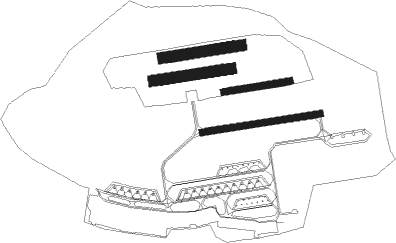
Runway info
Runway 09 / 27  | ||
| length | 533m (1749ft) | |
| bearing | 87° / 267° | |
| width | 30m (98ft) | |
| surface | asphalt | |
| Runway 08R / 26L | ||
| length | 299m (981ft) | |
| bearing | 87° / 267° | |
| width | 30m (98ft) | |
| surface | grass | |
| Runway 08C / 26C | ||
| length | 347m (1138ft) | |
| bearing | 87° / 267° | |
| width | 50m (164ft) | |
| surface | grass | |
| Runway 08L / 26R | ||
| length | 352m (1155ft) | |
| bearing | 87° / 267° | |
| width | 50m (164ft) | |
| surface | grass | |
Nearby beacons
| code | identifier | dist | bearing | frequency |
|---|---|---|---|---|
| NGD | DME | 16.9 | 357° | 113.10 |
| RTB | ROETHENBACH NDB | 16.9 | 31° | 415 |
| NUB | NUERNBERG VOR/DME | 17.2 | 348° | 115.75 |
| ANS | ANSBACH NDB | 18.9 | 281° | 452 |
| ERL | ERLANGEN VOR/DME | 26.3 | 7° | 114.90 |
| HFX | HOHENFELS NDB | 29.9 | 90° | 286 |
| NEU | NEUBURG TACAN | 30.7 | 167° | 108.90 |
| ILM | ILLESHEIM NDB | 31.5 | 290° | 488 |
| DKB | DINKELSBUEHL VORTAC | 33.9 | 265° | 117.80 |
| IGL | INGOLSTADT TACAN | 35.4 | 137° | 111.40 |
| IGL | INGOLSTADT NDB | 36 | 131° | 345 |
| WLD | WALDA VOR/DME | 38.4 | 177° | 112.80 |
| GRF | GRAFENWOHR TACAN | 43.4 | 61° | 111.80 |
| GRW | GRAFENWOHR NDB | 43.6 | 61° | 405 |
| MIQ | MIKE NDB | 43.6 | 142° | 426 |
| AUG | DME | 48 | 191° | 115.90 |
| AGB | AUGSBURG NDB | 48.1 | 192° | 318 |
| BAY | BAYREUTH VOR | 50.6 | 35° | 110.60 |
| MNE | MUNICH NDB | 56.7 | 146° | 369 |
| MSE | MUNICH NDB | 57.5 | 148° | 358 |
| MAH | MAISACH VOR/DME | 58 | 167° | 115.20 |
| DMN | DME | 58.1 | 141° | 116 |
| DMS | DME | 59.2 | 142° | 115 |
| MNW | MUNICH NDB | 60.1 | 136° | 338 |
| MSW | MUNICH NDB | 61 | 137° | 400 |
Disclaimer
The information on this website is not for real aviation. Use this data with the X-Plane flight simulator only! Data taken with kind consent from X-Plane 12 source code and data files. Content is subject to change without notice.