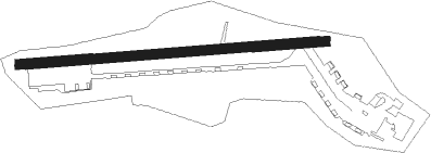
Hohenfels Aaf
Airport details
| Country | Germany |
| State | Bavaria |
| Region | ED |
| Airspace | Munich Ctr |
| Municipality | Hohenfels |
| Elevation | 1524ft (465m) |
| Timezone | GMT +1 |
| Coordinates | 49.21621, 11.83219 |
| Magnetic var | |
| Type | land |
| Available since | X-Plane v10.40 |
| ICAO code | ETIH |
| IATA code | n/a |
| FAA code | n/a |
Communication
| Hohenfels AAF Hohenfels Tower | 122.100 |
Nearby Points of Interest:
Burg Hohenfels (Oberpfalz)
-Burgstall Oedenthurn
-Abschnittsbefestigung Tischnerberg
-Schloss Emhof
-Burgstall Rohrbach
-St. Georg
-Unteres Schloss Schmidmühlen
-Burg Lutzmannstein
-Pfleghof
-Schlosskapelle St. Bartholomäus
-Schloss Winbuch
-Raitenbucher Schloss
-Silbermannsches Schlösschen
-St. Philipp und Jakob
-Hofmarksschloss Wischenhofen
-St. Peter und Paul (Beratzhausen)
-Kath. Filialkirche und Friedhofskapelle St. Sebastian
-Mariä Opferung (Duggendorf)
-Beratzhausen railway bridge
-Torhaus
-Burgstall Plankenstein (Velburg)
-Burgberg in Wolfsegg
-Schloss Leidersdorf
-St. Leonhard (Wall)
-St. Franz Xaver
Nearby beacons
| code | identifier | dist | bearing | frequency |
|---|---|---|---|---|
| HFX | HOHENFELS NDB | 1 | 86° | 286 |
| RTB | ROETHENBACH NDB | 27.7 | 295° | 415 |
| GRF | GRAFENWOHR TACAN | 28.8 | 13° | 111.80 |
| GRW | GRAFENWOHR NDB | 29 | 13° | 405 |
| RDG | RODING VOR/DME | 29.2 | 104° | 114.70 |
| IGL | INGOLSTADT NDB | 29.6 | 201° | 345 |
| IGL | INGOLSTADT TACAN | 31.6 | 208° | 111.40 |
| NGD | DME | 34 | 291° | 113.10 |
| NUB | NUERNBERG VOR/DME | 35.6 | 290° | 115.75 |
| ERL | ERLANGEN VOR/DME | 37.4 | 303° | 114.90 |
| NEU | NEUBURG TACAN | 38.9 | 231° | 108.90 |
| MIQ | MIKE NDB | 39.8 | 200° | 426 |
| BAY | BAYREUTH VOR | 46.8 | 346° | 110.60 |
| WLD | WALDA VOR/DME | 47.2 | 228° | 112.80 |
| MNW | MUNICH NDB | 50.6 | 174° | 338 |
| DMN | DME | 51 | 183° | 116 |
| MSW | MUNICH NDB | 51.9 | 175° | 400 |
| MNE | MUNICH NDB | 52 | 190° | 369 |
| DMS | DME | 52.6 | 184° | 115 |
| MSE | MUNICH NDB | 53.4 | 191° | 358 |
| OKG | CHEB VOR/DME | 55.6 | 34° | 115.70 |
| AUG | DME | 59.2 | 229° | 115.90 |
| AGB | AUGSBURG NDB | 59.3 | 229° | 318 |
| MAH | MAISACH VOR/DME | 60.8 | 209° | 115.20 |
Disclaimer
The information on this website is not for real aviation. Use this data with the X-Plane flight simulator only! Data taken with kind consent from X-Plane 12 source code and data files. Content is subject to change without notice.