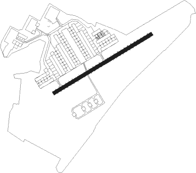
Storck Barracks - Illesheim Aaf
Airport details
| Country | Germany |
| State | Bavaria |
| Region | ED |
| Airspace | Langen Ctr |
| Municipality | Illesheim |
| Elevation | 1078ft (329m) |
| Timezone | GMT +1 |
| Coordinates | 49.47383, 10.38783 |
| Magnetic var | |
| Type | land |
| Available since | X-Plane v10.40 |
| ICAO code | ETIK |
| IATA code | ILH |
| FAA code | n/a |
Communication
| Illesheim AAF Illesheim Tower | 122.100 |
Nearby Points of Interest:
Friedhofsmauer, ehemalige Wehrmauer
-Rathaus
-Wildbad
-St. Peter und Paul (Gräfenbuch)
-Ansbacher Straße 26
-Zollhaus
-Amtsgericht Uffenheim
-St. Jakob Häslabronn
-Bildstock
-Evangelisch-lutherisches Pfarrhaus (Gattenhofen)
-Mariä Himmelfahrt
-St. Jobst
-Schloss Frankenberg
-Ansbacher Straße 2 (Rothenburg ob der Tauber)
-Judengasse 10
-Pferdeschwemme
-Town hall of Rothenburg ob der Tauber
-Hofbronnengasse 13
-Herrngasse 1 (Rothenburg ob der Tauber)
-Klosterhof 5, Konventsgebäude
-Ehemaliges Rathaus, heute Kindergarten
-Evangelisch-Lutherisches Dekanatamt Leutershausen
-Tauberzell 11
-Kirchenburg
-Bullenheim 47
Nearby beacons
| code | identifier | dist | bearing | frequency |
|---|---|---|---|---|
| ILM | ILLESHEIM NDB | 0.1 | 166° | 488 |
| ANS | ANSBACH NDB | 13.7 | 124° | 452 |
| NSN | NIEDERSTETTEN NDB | 17.1 | 259° | 311 |
| NDD | DME-ILS | 17.3 | 259° | 108.70 |
| DKB | DINKELSBUEHL VORTAC | 20.7 | 204° | 117.80 |
| NUB | NUERNBERG VOR/DME | 25.3 | 87° | 115.75 |
| NGD | DME | 27 | 88° | 113.10 |
| ERL | ERLANGEN VOR/DME | 31.6 | 77° | 114.90 |
| SHD | HALL DME | 32.1 | 240° | 108.05 |
| RTB | ROETHENBACH NDB | 33.7 | 89° | 415 |
| NEU | NEUBURG TACAN | 56 | 133° | 108.90 |
| WLD | WALDA VOR/DME | 61.1 | 140° | 112.80 |
Disclaimer
The information on this website is not for real aviation. Use this data with the X-Plane flight simulator only! Data taken with kind consent from X-Plane 12 source code and data files. Content is subject to change without notice.