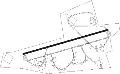
Cuxhaven - Nordholz Ab
Airport details
| Country | Germany |
| State | Lower Saxony |
| Region | ED |
| Airspace | Bremen Ctr |
| Municipality | Wurster Nordseeküste |
| Elevation | 74ft (23m) |
| Timezone | GMT +1 |
| Coordinates | 53.76599, 8.67112 |
| Magnetic var | |
| Type | land |
| Available since | X-Plane v10.40 |
| ICAO code | ETMN |
| IATA code | FCN |
| FAA code | n/a |
Communication
| Nordholz AB BREMEN INFO | 125.100 |
| Nordholz AB Nordholz tower | 122.100 |
| Nordholz AB RADAR | 129.850 |
| Nordholz AB RADAR | 123.300 |
Approach frequencies
| ILS-cat-I | RW08 | 108.55 | 18.00mi |
| ILS-cat-I | RW26 | 111.75 | 18.00mi |
| 3° GS | RW08 | 108.55 | 18.00mi |
| 3° GS | RW26 | 111.75 | 18.00mi |
Nearby Points of Interest:
St. Georgkirche
-Deichstraße 4
-Deichstraße 5 bis 8
-Rathaus Cuxhaven
-Wetterwarte Cuxhaven
-St. Severi
-Gut Valenbrook (Fickmühlen)
-Dionysiuskirche Debstedt
-Bederkesa railway station
-St. Jakobikirche
-Hof Rall
-Hof Sibbern
-Villa Weber
-Krankenhaus Lehe
-Villa Giese
-Alte Privilegierte Apotheke Lehe
-Amtsgericht Bremerhaven
-Rathaus Lehe
-Wohnanlage Werkblock
-Villa Hanssen
-Landratsamt Lehe
-Hannoversches Amtshaus
-Haus Dr. Diekmann
-Kalkofen
-Wohnhaus Hafenstraße 192
Nearby beacons
| code | identifier | dist | bearing | frequency |
|---|---|---|---|---|
| NDO | NORDHOLZ TACAN | 0.6 | 280° | 117.10 |
| NDO | NORDHOLZ NDB | 4.9 | 82° | 372 |
| WSN | WESER NDB | 26.1 | 154° | 378 |
| WTM | WITTMUNDHAFEN TACAN | 35.9 | 257° | 113.50 |
| DHE | HELGOLAND VOR/DME | 36.8 | 299° | 116.30 |
| BMN | BREMEN VOR/DME | 43.3 | 173° | 117.45 |
| BND | DME | 43.5 | 171° | 113.65 |
| HIG | BREMEN NDB | 43.8 | 162° | 318 |
| HNT | HOHN TACAN | 44.7 | 58° | 115.30 |
| HN | HOHN NDB | 48.7 | 61° | 344 |
| SWG | SCHLESWIG TACAN | 51.3 | 50° | 111.80 |
Disclaimer
The information on this website is not for real aviation. Use this data with the X-Plane flight simulator only! Data taken with kind consent from X-Plane 12 source code and data files. Content is subject to change without notice.