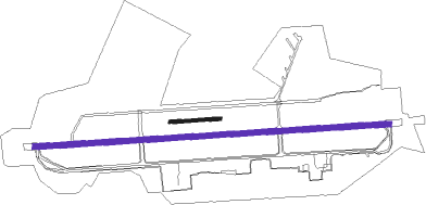
Geilenkirchen - Geilenkirchen Ab
Airport details
| Country | Germany |
| State | North Rhine-Westphalia |
| Region | ED |
| Airspace | Langen Ctr |
| Municipality | Geilenkirchen |
| Elevation | 293ft (89m) |
| Timezone | GMT +1 |
| Coordinates | 50.95768, 6.05281 |
| Magnetic var | |
| Type | land |
| Available since | X-Plane v10.40 |
| ICAO code | ETNG |
| IATA code | GKE |
| FAA code | n/a |
Communication
| Geilenkirchen AB Frisbee tower | 122.100 |
| Geilenkirchen AB Geilenkirchen Info | 120.050 |
| Geilenkirchen AB Langen radar | 128.500 |
| Geilenkirchen AB Frisbee radar | 123.300 |
| Geilenkirchen AB Frisbee radar | 123.725 |
Approach frequencies
| ILS-cat-I | RW27 | 110.1 | 18.00mi |
| 3° GS | RW27 | 110.1 | 18.00mi |
Nearby beacons
| code | identifier | dist | bearing | frequency |
|---|---|---|---|---|
| GIX | GEILENKIRCHEN TACAN | 0.4 | 307° | 108.10 |
| MAS | MAASTRICHT VOR/DME | 3.5 | 279° | 108.60 |
| NW | MAASTRICHT NDB | 7.5 | 289° | 373 |
| MHD | DME | 23.4 | 58° | 112.50 |
| MHV | MOENCHENGLADBACH VOR | 23.5 | 57° | 109.80 |
| NVO | NOERVENICH VORTAC | 23.5 | 103° | 116.20 |
| WNN | DME | 24.4 | 101° | 109.85 |
| ONL | LIEGE NDB | 24.5 | 243° | 290 |
| BBL | KLEINE BROGEL TACAN | 25.5 | 290° | 109.60 |
| LNO | OLNO VOR/DME | 25.8 | 223° | 112.80 |
| LMA | LIMA NDB | 27.9 | 40° | 311 |
| DY | DUESSELDORF NDB | 28.1 | 65° | 284 |
| LGE | LIEGE VOR/DME | 28.6 | 242° | 115.45 |
| SLV | SPA NDB | 29.2 | 196° | 386 |
| SPI | SPRIMONT VOR/DME | 31.2 | 224° | 113.10 |
| DUS | DUESSELDORF VOR/DME | 32.8 | 65° | 115.15 |
| FLO | FLORA VOR/DME | 35.1 | 265° | 112.05 |
| NID | DME | 38.7 | 8° | 115.50 |
| EHV | EINDHOVEN TACAN | 38.9 | 306° | 117.20 |
| LAA | NIEDERRHEIN NDB | 38.9 | 11° | 352 |
| LI | DUESSELDORF NDB | 39.2 | 65° | 417 |
| VKL | VOLKEL TACAN | 43.8 | 334° | 108.30 |
| BOT | BOTTROP NDB | 52.4 | 57° | 406 |
| SPA | SPANGDAHLEM TACAN | 63.7 | 147° | 109.50 |
Departure and arrival routes
| Transition altitude | 5000ft |
| SID end points | distance | outbound heading | |
|---|---|---|---|
| RW09 | |||
| MILG1B | 15mi | 17° | |
| NG91 | 12mi | 31° | |
| KENU1B | 16mi | 142° | |
| NG96 | 26mi | 223° | |
| RW27 | |||
| MILG1A | 15mi | 17° | |
| NG81 | 12mi | 31° | |
| KENU1A | 16mi | 142° | |
| NG86 | 26mi | 223° | |
Instrument approach procedures
| runway | airway (heading) | route (dist, bearing) |
|---|---|---|
| RW09 | ALESU (288°) | ALESU 2500ft VALOB (20mi, 271°) 2500ft NG402 (5mi, 1°) 2500ft |
| RNAV | NG402 2500ft GELNU (4mi, 90°) 2000ft ETNG (6mi, 92°) 314ft NG404 (2mi, 88°) ALESU (9mi, 114°) 2500ft | |
| RW27 | ALESU (288°) | ALESU 2500ft NG401 (5mi, 2°) 2100ft |
| RW27 | KETIG (270°) | KETIG 3500ft NG401 (2mi, 271°) 2100ft |
| RW27 | LINPU (252°) | LINPU 3500ft NG401 (5mi, 182°) 2100ft |
| RNAV | NG401 2100ft TETGI (4mi, 271°) 2000ft ETNG (6mi, 269°) 340ft NG427 (4mi, 272°) ALESU (15mi, 103°) 2500ft |
Disclaimer
The information on this website is not for real aviation. Use this data with the X-Plane flight simulator only! Data taken with kind consent from X-Plane 12 source code and data files. Content is subject to change without notice.

